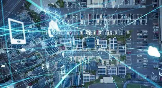
How do emerging technologies affect the geospatial industry?
Technological advances and innovations such as artificial intelligence, cloud computing and big data have changed the way business is conducted in the past few years. This sustainable development has also led to the development of the digital technology environment, thus accelerating the global influence and contribution of the geospatial industry.
The industry is involved in collecting, storing, processing, absorbing, managing, mapping, evaluating and distributing data connected to specific locations around the world. Geospatial technologies include geographic information systems (GIS) / spatial analysis, global navigation satellite systems (GNSS) and positioning, earth observation and scanning.
With the continuous growth of technological progress, the world will see the integration of geospatial technology and artificial intelligence and its subsets, machine learning and deep learning. Although these cutting-edge technologies are still in their infancy, it is important for industry participants to begin to understand the impact of these solutions in the future. Here, we have accumulated some emerging technologies that will affect and affect the geospatial industry in the next few years.

Artificial intelligence
Artificial intelligence fundamentally changes the work, operation and analysis support of enterprises, and provides more intelligence opportunities for cross-departmental entities. Its machine learning subset includes building statistical models based on sample data to make estimates or decisions without explicit programming. Geospatial companies use this technology to a large extent, enabling systems to gain insights and make effective decisions from structured and unstructured data sets with minimal human intervention.
Moreover, the GIS system carries a large amount of information classified by geographical location, which constitutes an excellent training data set of the AI system. This connection with AI is essential in the latest developments in computer vision and image recognition. The integration of AI with other emerging technologies such as the Internet of things (IoT) will also bring huge new opportunities to the geospatial field.
Cloud Computing
The development of cloud infrastructure has provided big data's analytical progress for geospatial technology, because the GIS system contains a large amount of information from geographic location. These advances provide a flexible on-demand computing platform for geospatial data to combine observation systems, parameter extraction algorithms, phenomenon simulation, analysis visualization and decision support. This further promotes social impact and user feedback, which is an important element of geospatial science.
Advanced computing networks (such as CyberGIS) and cloud computing services (such as cloud GIS) provide channels for governments, and other countries to more easily, quickly access and contribute to the growing repository of geospatial data, tools, and services.
Big data
Big data of this department refers to data sets that exceed the current system capacity. The traditional geo-spatial data including remote sensing data are structured and analyzed in data analysis systems such as GIS. However, with the advent of faster, wider wireless and Web networks, modern data with useful geospatial content such as photos, social media chats, videos, voice and messages now account for nearly 80 per cent of the total data. Its unstructured form cannot be used in conventional analysis systems such as GIS, and the amount of data generated by these platforms far exceeds the available data storage capacity. As a result, big data here has improved innovation and sustainability, and can turn huge reserves into billions of dollars in savings.
The geospatial industry includes individuals who research, develop, manufacture and deploy geospatial technologies, private companies, non-profit organizations, academic and research institutions, and government entities.