ArcMap intersection analysis intersect solves the problem that features fall into another multi-part vector face feature
In GIS analysis, we often encounter the problem of "distribution of XX elements in XX elements". For example, there are vector surface data of a certain land use type distribution, as well as vector surface data of China's administrative divisions. I want to analyze the distribution of this land use type in various provinces; Or in remote sensing, we want to explore which remote sensing image segmentation covers our research area. When the area and partial distribution of elements are complex, how about solving the problem of "distribution of XX elements in XX elements"?
In ArcMap, this operation can be well implemented based on "intersection analysis". Let's take the second question as an example to explain it in detail.
At present, we know a vector surface element covering Asia, Oceania and other regions, as well as the vector surface element of global framing of MODIS remote sensing images. It is necessary to explore which MODIS framing strip numbers cover the region.
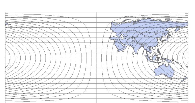
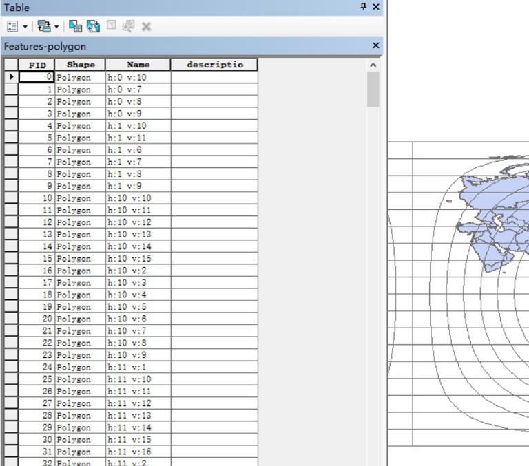
Among them, the attribute table of the vector face feature in the case of tiling has its tiling number (i.e., h and v numbers).
Once the requirements are clear, we will begin to operate. In ArcMap, select Analysis Tools.tbx → Overlay → Intersect.
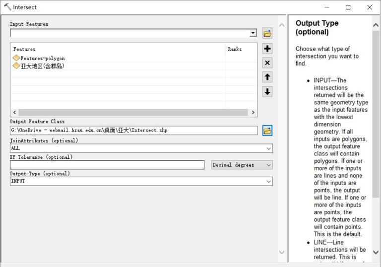
Put the above two vector face features into "Input Features" as input features; The second item is the path and name of the output element, and the third item is the attribute union, which determines which fields in the attribute table of each element in the original input element will continue to appear in the output element, which is generally the default; The fourth item is the minimum tolerance between elements; The fifth item is the type of output elements.
After the operation is completed, the results are as follows.
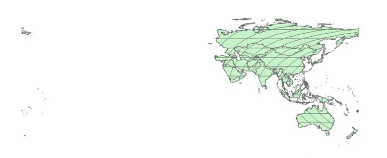
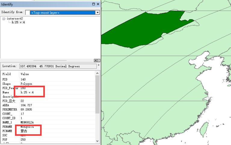
As you can see, the result layer exists independently according to each independent part of the input layer. For example, the green part below shows the intersection of Mongolia and the region with MODIS hv numbers of 25 and 4 respectively.
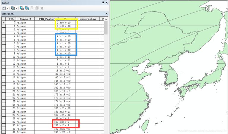
Although the intersection of the two is obtained, there is still a problem: I want to know which MODIS tiles cover this area, but the elements obtained now become very scattered, and the same tile number will appear in multiple element parts, as shown in the following figure. This seriously interferes with the confirmation of the division number.
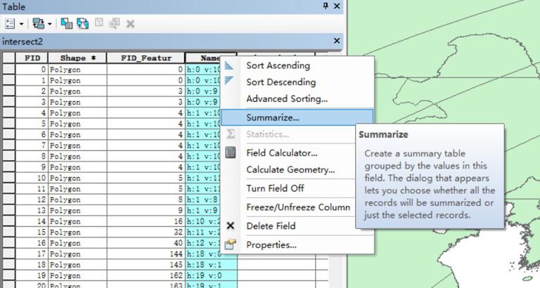
So how to solve this problem? This can be achieved by "Summarize..." in the property sheet. Select the column of hv tiles, and right-click to select "Summarize...".
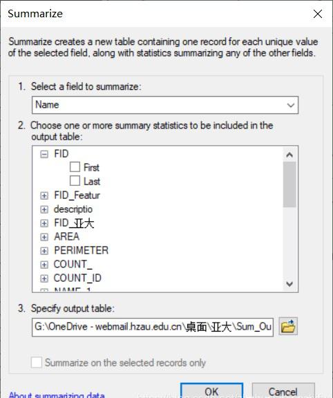
In the pop-up interface, directly configure the path and name of the output table.
Then import the table just generated into ArcMap.
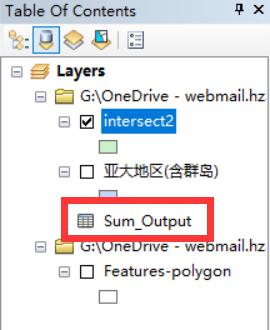
Right-click and select "Open".

You can see the unique value of each tile. These tiles are the tile strip numbers that appear in the study area.
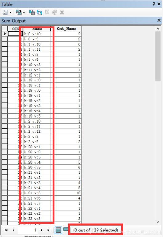
At the same time, you can also see the specific number of tiles in this area at the bottom.