Current situation and development trend of the combination of GIS and Remote Sensing
GIS and remote sensing technology play an important role in spatial data processing and image analysis. As early as in the 1960s, remote sensing technology entered the aerospace phase from the aviation phase, and an image analysis system was produced that was used to analyze and process images by computers. Since then, geographic information system and remote sensing began to combine. Although GIS and remote sensing have embarked on the road of integrated development, their integration is not deep enough and needs further improvement. This paper makes a correlation analysis on the current situation and development trend of the combination of GIS and remote sensing.
Geographic information system (GIS) and remote sensing are two independently developed technical fields. With the continuous expansion of their applications in their respective fields, the trend of their combination is becoming more and more obvious. Under the current economic situation, data is becoming more and more sensitive and important, especially spatial data. If you want to effectively use spatial data, you must rely on scientific technology. The application of GIS and remote sensing technology can realize the monitoring from qualitative to quantitative, from static to dynamic. With the continuous development of science and technology in China, the combination of GIS and remote sensing is gradually deepening, and the application in modern society will be more and more extensive.
1.Analysis of the need for a combination of GIS and remote sensing
Geographic information system (GIS) is a strange technology developed on the basis of computer technology. It can analyze and process spatial information. Geographic information system has the ability to collect, manage, analyze and output a variety of geospatial information. At the same time, the system has strong spatial comprehensive analysis and dynamic prediction capabilities, and can produce high-level geographic information. Remote sensing is a technology to detect and identify remote research objects by means of space vehicles and modern electronic and optical instruments. Remote sensing technology can observe a large area from the air and even from the space in a relatively short time, and obtain valuable remote sensing data from it. At the same time, the data obtained through remote sensing is comprehensive and can comprehensively reveal the correlation between geographical things. From the perspective of geographic information system, the application of geographic information system is getting deeper and deeper. It requires not only to store a large amount of relevant data, but also to update the data in the system in a timely manner to maintain the dynamic type of the system. Remote sensing technology can monitor a wide range of data dynamically. Remote sensing can become a very important information source of geographic information system. From the perspective of remote sensing technology, Remote sensing is transitioning from a single sensor data analysis application to a multi band, multi temporal analysis application, and from qualitative survey mapping to quantitative statistical analysis. During this transition period, an effective information system is needed to process relevant data, and geographic information system undoubtedly better meets the needs of remote sensing development. Therefore, it is necessary to combine GIS with remote sensing.
2.Status of the integration of GIS and remote sensing
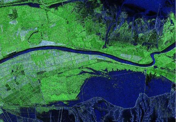
Geographic information system and remote sensing are two space technology tools supporting modern geography. With the continuous deepening of geographical research, the combination of geographic information system and remote sensing has also been highly concerned. Although geographic information system (GIS) and remote sensing are two independently developed technical fields, they are closely related. The combination of the two can achieve complementary advantages and improve data processing efficiency. At this stage, the combination of GIS and remote sensing is also developing from the primary stage to the advanced stage. The technology level of the combination of GIS and remote sensing is also constantly improving, and its application is becoming more and more in-depth. In the military aspect, geographic information system can be used for terrain detection, military target tracking and monitoring, aircraft positioning, battle command, etc. Especially with the continuous deepening of remote sensing technology research, battlefield simulation becomes possible. With the support of geographic information system and remote sensing technology, it can simulate the battlefield environment, understand the operational environment, and conduct military exercises and training. In addition, the combination of geographic information system and remote sensing technology has provided a new research means for earth science, which has greatly changed the research scope, content and methods of earth science and gradually formed the core of earth information science. From the perspective of the current research situation of geographic information system and remote sensing technology in China, China has invested a lot of energy and time in the research of geographic information system and remote sensing technology, and has made great achievements. Various research achievements provide important support for human beings to study the earth and understand the geographical environment.
With the continuous research on science and technology, digital integration has developed some methods to provide map and image data for different levels of mutual access and call. With the help of geographic information system, some images and data can be effectively processed. For example, geographic information system not only has a set of vector analysis software, but also has image input, enhancement, display and other functions. Through geographic information system, corresponding instructions can be called to improve data processing efficiency. Although the technical level of the combination of GIS and remote sensing continues to improve, there are still technical problems that need to be overcome. In the future, we need to spend more time and energy on the research of the combination of GIS and remote sensing technology to continuously improve the technical level.
3.Development trend of combination of GIS and remote sensing
3.1 Processing information with artificial intelligence technology
With the in-depth study of GIS and remote sensing technology, GIS needs to process more and more data. To improve the efficiency of data processing, GIS must be upgraded and improved, relying on scientific technology to replace manual processing. Artificial intelligence refers to the development of machine intelligence based on human intelligence by following artificial methods and technologies. In the process of the combined development of GIS and remote sensing, in-depth research on AI technology will better meet the needs of the development of GIS. With AI technology as the carrier, data processing efficiency in GIS can be improved, and dynamic data and geographic environment can be better monitored.
3.2 Satellite remote sensing shows miniaturization, diversification and specialization
With the further study of the earth, there are more and more man-made satellites. GIS and remote sensing technology will be used in artificial satellites. However, in the early days, satellites were bulky, bulky, and consumed many materials. In this environment, people began to go deep into the "faster, better, and more economical" research of aerospace technology. Looking at remote sensing technology, from the band range, satellite remote sensing covers the spectrum range of visible light, infrared, microwave, etc; From the point of view of satellite weight, the development of small satellites is toward economic and efficient, which reflects the trend of small spacecraft technology toward "faster, better and more economical".
3.3 Further combination of remote sensing technology and various high and new technologies
At present, the combination of geographic information technology and remote sensing technology has achieved good results, but the combination level is not high enough, and more technical cooperation is needed. At present, remote sensing technology is playing an increasingly important role in building a digital earth and digital city, which are closely related to RS, GIS, GPS and other technologies. In this regard, the combination of geographic information technology and remote sensing technology in the future should introduce other technologies and improve itself, with the advantages of other technologies, so as to make the technical achievements more advanced and perfect.
3.4 Industrialization development
With the continuous development of science and technology, RS, GIS and GPS have also gone deep into many fields of national economy and social development in China, playing an increasingly important role in national environmental survey, military, national security and other aspects. At present, RS, GIS and GPS are gradually moving towards the road of industrial development from the previous research institutes and universities, and showing a good development. Therefore, in the process of promoting the integration of GIS and remote sensing, we should recognize the situation and trend of industrialization, constantly create a good development environment, and actively promote the development of technology industrialization.
4.Conclusion
To sum up, geographic information system and remote sensing are important achievements of technological development and play an important role in social development. They are not only conducive to economic development, but also conducive to increasing the comprehensive strength of the country. Under the current social and economic situation, the combination of GIS and remote sensing is becoming more and more obvious. Promoting the high-level combination of GIS and remote sensing, as well as the combination of comprehensive analysis and dynamic monitoring, can achieve complementary advantages and better serve social development. In the future, we will continue to deepen the research on geographic information system and remote sensing technology, and constantly improve the technology level of combining geographic information system and remote sensing, so as to play a better role in technology.