Landsat series remote sensing satellite WRS strip number Path Row tile introduction and space location diagram
WRS, the Worldwide Reference System, is the Landsat series satellite global image marking symbol system, which is used to distinguish the corresponding Landsat series satellite image numbers in various regions of the world; It uses the two values of "Path" and "Row" to determine the number and position of the image. The corresponding numbering system of Landsat 1, 2 and 3 satellites is WRS-1, and the corresponding numbering system of Landsat 4, 5, 7 and 8 satellites is WRS-2. Since we currently mainly use Landsat 4, 5, 7 and 8 satellites, this paper will introduce the distribution of WRS-2 in detail.
WRS-2 includes two modes: Descending (day star, that is, day transit at local time) and Ascending (night star, that is, night transit at local time). Among them, Landsat 7 is a descending satellite, and Landsat 8 is both, but it is mainly a descending satellite.
Let's first take a look at the band number segmentation of global Descending:

Let's take a look at the band number segmentation of global Ascending:

It can be found that the curves between the two are opposite to each other, and there is no obvious difference between them. Because the two are similar, the subsequent content of this article is directly based on the strip number of Descending. You can operate as needed.
Right-click the layer name in the layer list and select "Label Features" to add the strip number label to the Descending strip number tile, that is, the specific value of "Path" and "Row".

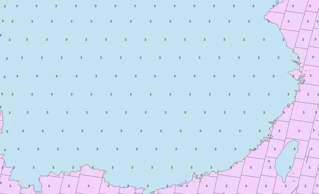
With dense labels, it can hardly be seen clearly; Let's take China as an example to see the specific situation. First of all, let's still look at the overall situation of the world.

Take the southeast of China as the center to zoom in. At this time, we found that the original label is a letter "D", which is probably the meaning of "Descending". But the key is that what we want to see is the value of "Path" and "Row". What is the meaning of just looking at a letter?
Don't worry, just modify the content displayed on the label, as shown below.
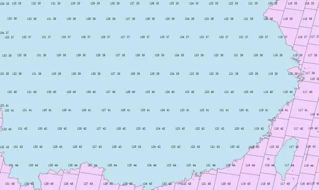
Well, that's clear.
In this way, the corresponding Landsat series satellite strip number of the study area can be determined, so that it can be downloaded conveniently.