Advantages and disadvantages of 3D GIS technology
Comparison of advantages and disadvantages between mapgis and arcgis
The advantages and disadvantages are as follows:
Differences in software development: Mapgis is a universal tool based GIS software developed by China University of Geosciences, while Arcgis is developed by the ESRI Environmental Systems Research Institute in the United States and widely used worldwide.
Cost difference: The procurement cost of mapgis software is lower than that of arcgis software. Secondly, the library files used in the first phase of the ArcGIS project have been recorded compared to MapGIS and can be used directly. However, the library files used in the first phase of the ArcGIS project need to be changed again, which greatly increases the cost.
Differences in mapping functions: Mapgis software uses CMYK printing color format, which is more realistic and effective in displaying colors in the geological field. However, arcgis software uses RGB color format, and there are certain color difference in the mapping process.
Differences in database systems: The database format of MapGIS software does not have a unified standard, and specific bytes are not specified in the fields. Therefore, errors often occur when converting to ArcGIS software format, and modifications and checks are very cumbersome. However, there were no errors in the conversion from the ArcGIS software database to the MapGIS software.
Differences in scalability and application scope: MapGIS software has limited capabilities in 3D and development, and its analytical functions cannot be compared to ArcGIS software, which is much more specialized than MapGIS. Therefore, ArcGIS software is widely used globally, while MapGIS software is the most widely used in China.
What are the drawbacks of GIS?
Based on the above research on the current status of GIS technology, this article analyzes and believes that GIS technology has shortcomings in models, data structures, and other aspects, which to some extent restricts the development of GIS technology.
Firstly, there are issues with data structure. At present, the commonly used GIS mainly includes vector, grid, or hybrid systems that add the two. Even hybrid systems actually store the two types of data separately, using different data forms when different tasks need to be performed. In terms of vector structure, its disadvantage is that processing positional relationships is quite time-consuming and lacks the ability to directly combine with DEM and RS. In terms of grid structure, there are problems such as low resolution and poor accuracy of grid data, difficulty in establishing topological relationships between ground objects, difficulty in operating individual targets, and large storage capacity of grid data.
Secondly, there are issues with GIS models. The traditional GIS model uses computer methods to unnaturally segment and abstract the geographical space of the objective world, which makes it difficult for people's cognitive models of geographical space to form a good correspondence with the data models in the computer, making it difficult to express complex geographical entities, and even more difficult to meet the overall feature requirements of the objective world. At present, object-oriented data models have to some extent addressed some of the shortcomings of traditional GIS data models, but they have not been widely accepted in the market and critical task applications because as a DBS, it is not yet mature and lacks a completely non procedural query language, as well as views, authorization, dynamic pattern updates, and parameterized performance coordination.
There are also some other issues. Currently, GIS is in a period of great transformation, and its further development still faces many problems, mainly manifested in the following aspects: Methodology issues in GIS design and implementation. The lack of guidance from object-oriented cognitive methodology and object-oriented programming methodology in the process of GIS design, and implementation leads to poor reliability and maintainability of GIS software systems The functional issues of GIS. At present, GIS, which focuses on data collection, storage, management, query and retrieval, cannot meet the requirements of social and regional sustainable development in spatial analysis, forecasting, decision support, etc., and directly affects the application benefits and vitality of GIS; 3D GIS model and visualization issues. At present, most GIS software's graphic display is based on two-dimensional planes, and even three-dimensional effects are displayed using the method of DEM to handle and express the undulations of the terrain. When it comes to natural and artificial phenomena that are truly three-dimensional underground, it seems powerless.
What is 3D GIS? What is its purpose?
Geographic Information System (GIS) is sometimes referred to as a "geoscience information system" or "resource and environmental information system". It is a specific and very important spatial information system. It is a technical system supported by computer hardware and software systems that collects, stores, manages, calculates, analyzes, displays, and describes geographic distribution data in the entire or part of the Earth's surface (including the atmosphere) space.
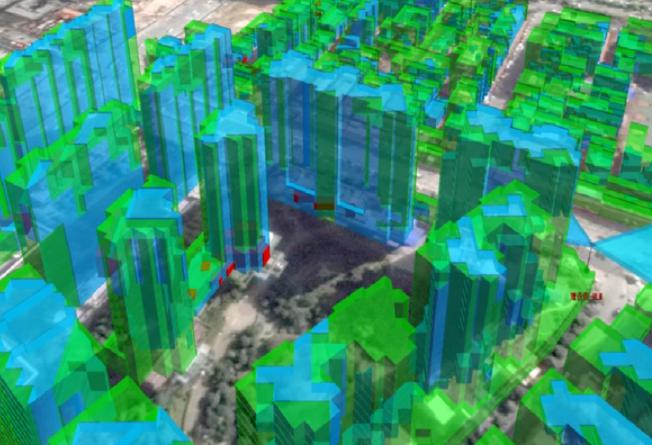
3D is the representation and display of data after collection and calculation analysis. Compared to 2D data, 3D data can better represent objective reality.
3D GIS, like 2D GIS, requires the most basic spatial data processing functions, such as data acquisition, data organization, data manipulation, data analysis, and data representation. Compared to 2D GIS, 3D GIS has the following advantages.
The display of spatial information is more intuitive. Since people understood how to understand and transform the world through spatial information, spatial information mainly exists in a graphical form. However, using a two-dimensional graphical interface to display spatial information is very abstract and only professionals can understand how to use it. Compared with 2D GIS, 3D GIS provides a richer and more realistic platform for the display of spatial information, enabling people to visualize and visualize the abstract and difficult spatial information visualization. People can understand it by combining their own relevant experience, so as to make accurate and rapid judgments. Undoubtedly, 3D GIS has unique advantages in visualization. Although the dynamic interactive visualization function of 3D GIS also puts special requirements on computer graphics technology and computer hardware, the emergence of some advanced graphics cards, workstations, and projection devices with touch function not only fully meets the visualization requirements of 3D GIS, but also brings unexpected display and experience effects.
Multidimensional spatial analysis is more powerful. The analysis process of spatial information is often complex, dynamic and abstract. In front of a large number of spatial information with complex relationships, the spatial analysis function of 2D GIS often has certain limitations, such as submergence analysis, geological analysis, sunshine analysis, spatial diffusion analysis, visibility analysis and other advanced spatial analysis functions, which cannot be realized by 2D GIS. Since 3D data itself can be reduced to 2D, 3D GIS can naturally contain the spatial analysis function of 2D GIS. The powerful multi-dimensional spatial analysis function of 3D GIS is not only a leap of GIS spatial analysis function, but also fully reflects the characteristics and advantages of GIS to a greater extent.