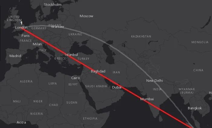
Distance and examples in GIS
Distance in GIS
- Geodesic distances: The shortest distance between two points on a geodetic surface.
- Planar distances: The shortest distance between two points on a geometric plane.
GIS distance measurement method
- Using distance measurement tools
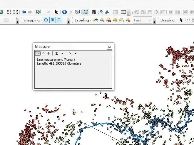
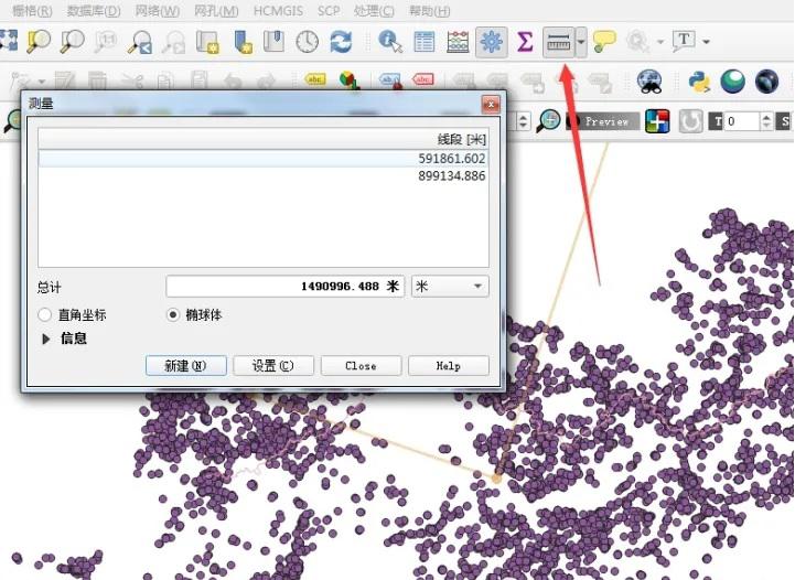
- Draw a line feature, view attributes.
ArcGIS geographic database feature classes can directly view the Shape_ Length field.
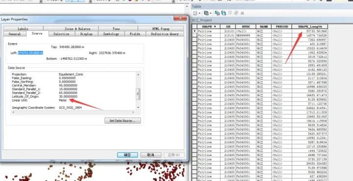
Shape can be viewed in the QGIS GPKG database_ Leng field.
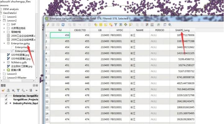
In the projection coordinate system, the unit is "meter", and in the geographical coordinate system, the unit is "degree"!
Calculation of distance from point to line
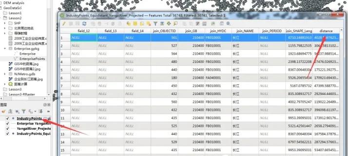
Take the distance from each enterprise to the Yangtze River as an example:
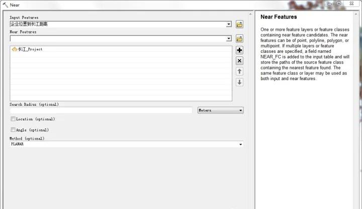
In ArcGIS, you can use the ArcToolbox-Analysis Tools-Proximity-Near tool to calculate the shortest distance from the enterprise to the Yangtze River, where the Input Features are the enterprise (point) and the Near Features are the Yangtze River (line).
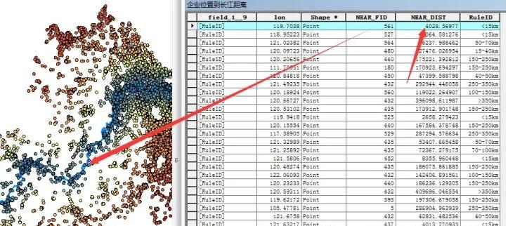
The calculation result will generate two fields, NEAR_ FID, NEAR_ DIST, NEAR_ FID refers to the Yangtze River element ID closest to the enterprise, NEAR_ DIST is the shortest distance between them.
So, how to do it in QGIS?
The NNJoin plug-in can be used for calculation in QGIS. Here, the Input vector layer is the enterprise, and the Join vector layer is the Yangtze River.
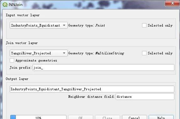
After the calculation is completed, a new vector is generated, and the distance field in the attribute table is the calculated closest distance.
Filter by distance
Screening restaurants within 500m of the subway station:
Data: subway stations (points), restaurant POIs (points)
In ArcGIS, you can directly select by location and specify a search radius of 500m to filter out restaurants within 500m.
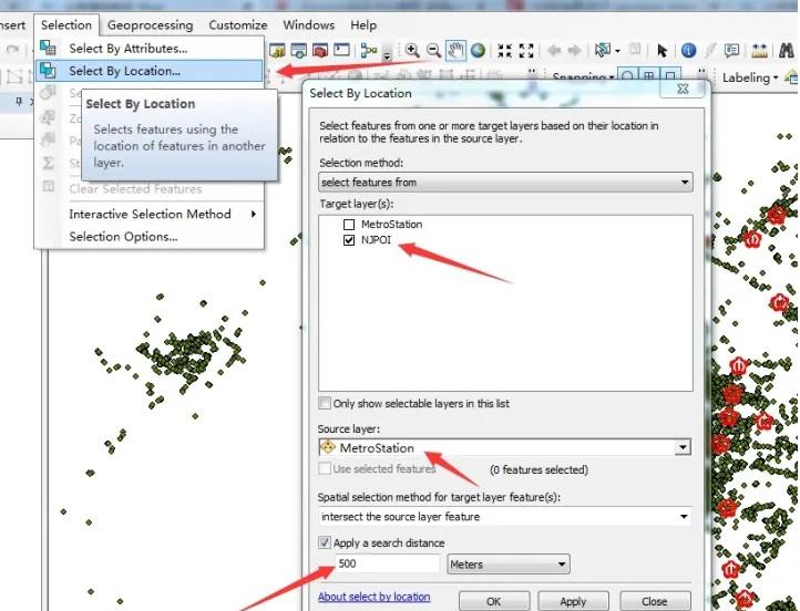
Currently, I have not found a very convenient method in QGIS. I can only create a buffer first, and then use the buffer to select by location.