Introduction to 9 Chinese platforms for downloading satellite remote sensing data
Page Views: Stats unavailable
1.Natural resources satellite remote sensing cloud service platform
( http://sasclouds.com/chinese/home )
The natural resources satellite remote sensing cloud service platform is supported by the cloud computing environment, with multi-platform, multi-temporal, multi-scale and multi-level satellite image products as resources, and the main task is to push, manage and distribute domestic remote sensing satellite image products based on natural resources land in real time. Its purpose is to build a global virtual satellite image data service center, realize the real-time sharing and efficient utilization of domestic high-resolution terrestrial satellite image products of natural resources in domestic and international natural resource management and various industries, and meet the global Earth observation needs of natural resource management and satellite remote sensing images.
2.China Remote Sensing Data Sharing Network
(http://eds.ceode.ac.cn/sjglb/dataservice.htm)
China Remote Sensing Data Network is a network service platform for earth observation data set up by the Remote Sensing Earth Institute to implement a new data distribution service model and further improve the data service level for users across the country. Through this platform, we can provide users across the country with the latest developments in the Institute's Earth observation data service, integrated online ordering and distribution of satellite data, interactive data processing and processing requirements, data application solutions, standards and data sharing of Earth observation data, so as to better meet the requirements of users across the country, especially national major projects, for the universality, diversity and timeliness of data, serve the country's economic construction.
Note: This is the data website with the longest archiving period in China. It can share the received data of LANDSAT series for free, and can also order foreign commercial satellite data. The Earth observation data sharing plan can download time-series quantitative remote sensing products and mosaic maps of China and Central Asia. (Account registration can be downloaded directly through audit.)
3.China Remote Sensing Data Sharing Network - RTU products
( http://ids.ceode.ac.cn/rtu/)
The product types shared this time include mosaic products, orthophoto products, fusion products, satellite-borne reflectance/satellite-borne brightness temperature products, and surface reflectance/land surface temperature products further developed on the basis of satellite-borne reflectance/satellite-borne brightness temperature. The geographical coverage includes China's land and five Central Asian countries (Kazakhstan, Kyrgyzstan, Tajikistan, Uzbekistan and Turkmenistan).
Note: Based on the LANDSAT series satellite data, four quantitative remote sensing products and image mosaic products have been carried out in China and Central Asia in 2000, 2005, 2010 and 2014, and long-term time-series products have been provided in the Yangtze River Delta, the Pearl River Delta and the Yellow River estuary since 1986. (Account registration can be downloaded directly through audit.)
4.China Resources Satellite Center
( http://218.247.138.119:7777/DSSPlatform/index.html )
The Center undertakes the construction and operation management of China's earth observation satellite data processing, archiving, distribution and service facilities, actively expands the field of satellite applications, provides a macro decision-making basis for the country's economic construction and social development, provides various kinds of earth observation data products and technical services for the users of the country, and provides research results. The center undertakes the important task of national earth observation and is one of the three major satellite application centers of the country.
Note: Collect domestic satellite data, free registration can download HJ satellite data, and high score data download needs to be submitted for approval.
5.Geospatial data cloud
( http://www.gscloud.cn/ )
At present, it has image data resources including LANDSAT, MODIS, EO-1, DEM, NCAR, NAAA, and LUCC data sets. In addition to mirroring domestic raw data, the platform has carried out high-quality data value-added product processing and accumulated a batch of data products on the basis of comprehensive research on domestic and foreign development trends and domestic user needs.
Note: The domestic LANDSAT data is synchronized from the USGS in the United States, and the MODIS products are downloaded by many scholars. The data resource update is relatively stable, and there are crowdsourcing services. (Account registration, direct download through audit).
6.Global change scientific research data publishing system
(http://www.geodoi.ac.cn/WebCn/Default.aspx)
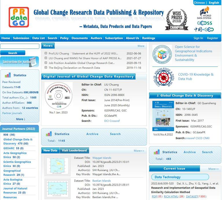
The "Global Change Scientific Research Data Publishing and Sharing System" was founded in 2014. The project team has done a lot of innovative work, accumulated a number of scientific data at home and abroad with considerable scientific value, laid a solid foundation for the system construction, and made remarkable achievements. In 2017, the Journal of Global Change Data (Chinese and English) was founded, which further improved the "global change scientific research data publishing and sharing system", well solved the problem of intellectual property protection of scientific data, and promoted the sharing of scientific data. Academician Xu Guanhua, former minister of the Ministry of Science and Technology of China, praised it as "a new milestone in China's scientific and technological data sharing".
Note: Data for scientific research purposes can be downloaded here. There are a variety of data types and many fields involved. You can find them according to your needs, and you will be surprised. (Account registration, direct download through audit).
7.National integrated earth observation data sharing platform
(http://chinageoss.org/dsp/home/index.jsp)
Domestic satellite data: resource series, high scores, meteorology, ocean, environment, fast boat, Beijing-1, etc;
Domestic satellite data: LANDSAT series, MODIS, EO-1, IRS-P6, ENVISAT-1, ERS-2, RESOURCESAT-1
Note: The National Remote Sensing Center issues a global ecological environment remote sensing monitoring report once a year, in which many data can be shared and downloaded, especially large-scale ones, which are highly scientific, and some data sets are downloaded by ordinary users without permission. (Account registration, immediate use).
8.Geographic and national conditions monitoring cloud platform
(http://www.dsac.cn/)
The geographic situation monitoring cloud platform mainly consists of two parts, the spatiotemporal data platform and the numerical simulation research platform. In particular, based on the existing ecological environment science model library, the tool library related to numerical simulation has been developed and integrated with the spatiotemporal data platform to form a domestic leading level of ecological environment science numerical research environment.
Note: The national data here mainly consists of seven common satellite data sources, including four foreign satellite data and three domestic satellite data products, which are rich in resources and have great influence.
9.Remote sensing market
( http://www.rscloudmart.com/ )
The remote sensing bazaar cloud platform, in conjunction with the national high-resolution satellite remote sensing data distribution channel, with remote sensing data service as the core, and technology and product value-added services as the revenue mechanism, has established an industrial remote sensing cloud service platform that integrates remote sensing data, thematic information products, analysis and processing software, storage and computing facilities, business application systems, mobile terminal integration, and sharing.
Note: It belongs to China Science and Technology Remote Sensing Group, and both domestic and foreign data are available. PLANET data can be purchased, and the download needs to be paid. Some free data can be paid attention to preferential activities.