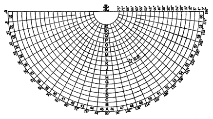
The national basic scale topographic maps are 1:100, 1:25,000, 1:50,000, 1:100, 1:200, 1:500, and 1:10 million. Ordinary maps are usually divided into large, medium and small scales. Generally, maps with a scale of 1:100,000 and larger scales are called large scale maps; 1:100,000 to 1:100 million are called medium scale maps; less than 1 : 1 million is called a small scale map. For a country or a world, the framing number is especially necessary when measuring the various scale topographic maps. Usually this is a unified frame framing and numbering system developed by the national authorities. Currently, the topographic map sheet division scheme adopted in China is based on the 1:1,000,000 topographic map, with larger-scale topographic maps defined using the same longitudinal and latitudinal differences. For the 1:1,000,000 map sheets within the latitude range of 0° to 60°, the sheet dimensions are divided based on a longitudinal difference of 6° and a latitudinal difference of 4°. For map sheets within the latitude range of 60° to 76°, the longitudinal difference is 12° and the latitudinal difference is 4°. For map sheets within the latitude range of 76° to 80°, the longitudinal difference is 24° and the latitudinal difference remains 4°.Therefore, all 1:1,000,000 map sheets are divided with a longitudinal difference of 6° and a latitudinal difference of 4°. The subdivision of larger-scale topographic maps within each 1:1,000,000 map sheet follows defined intervals of longitude and latitude. Specifically, the 1:500,000, 1:200,000, and 1:100,000 scale maps are directly derived from the 1:1,000,000 sheet. One 1:1,000,000 sheet is divided into four 1:500,000 sheets, each spanning 3° in longitude and 2° in latitude; into thirty-six 1:200,000 sheets, each covering 1° in longitude and 40’ in latitude; and into 144 1:100,000 sheets, each with a longitude span of 30’ and a latitude span of 20’. Each topographic map larger than 1:100,000 scale is divided step by step on the basis of 1:100,000 map, one 1:100,000 topographic map is divided into four 1:50,000 topographic maps, and one 1:50,000 topographic map is divided into four 1:25,000 topographic maps. On the basis of 1:100,000 map, 64 1:10,000 topographic maps are divided, and one 1:10,000 topographic map is divided into 4 1:5,000 topographic maps (see Table 4-1). Table 4-1: The size of basic scale topographic maps and the quantitative relationship between maps. Scale (10000) Picture size Quantitative relationship between map frames Longitude Latitude 1:100 6 degrees 4 degrees 1 1:50 3 degrees 2 degrees 4 1 1:20 1 degree 40 minutes 36 9 1 1:10 30 minutes 20 minutes 144 36 4 1 1:5 15 minutes 10 minutes 576 144 16 4 1 1:2.5 7.5 minutes 5 minutes 2304 576 64 16 4 1 1:1 3 minutes 45 seconds 2.5 minutes 9216 2304 256 64 16 4 The numbering of topographic maps is to give a fixed number to each map according to the division of topographic maps of various scales. This number can not be repeated, and it should be kept systematic. The most basic method of topographic map numbering is to use the determinant method, that is, to make a number of rows and columns in a certain range of each map. This kind of topographic map is numbered as a global uniform block number. Number of columns: from equator to North and south poles with latitude difference of 4 o for a row, up to 88 north and 88 south o (North-South latitude 88) o to the North and South Poles, polar projection is used to map the two hemispheres separately. The two hemispheres are divided into 22 columns, using the Latin letters A, B, C and D, respectively. V says. Number of rows: from longitude 180 o from east to east every six o for a row, there are 60 rows around the earth, with numbers 1, 2, 3, 4… 60 indicates. Since the longitude of the two hemispheres is the same, it is stipulated to add an S before the map number of the southern hemisphere and no sign before the map number of the northern hemisphere. Generally speaking, the letters of column number are written in front, the numbers of rows are written in back, and the middle is connected by a short line. For example, one millionth of Beijing’s map is numbered J-50 (as shown in Figure 14). As the Earth’s meridians converge toward the poles, the latitudinal arc length corresponding to the same 6° longitudinal difference gradually decreases with increasing latitude. Therefore, it is stipulated that map sheets within latitudes 60°–76° are formed by merging two standard sheets (with a longitudinal difference of 12° and a latitudinal difference of 4°), while map sheets within latitudes 76°–88° are formed by merging four standard sheets (with a longitudinal difference of 24° and a latitudinal difference of 4°). For the numbering of these merged map sheets, the column designation remains unchanged, while the row numbers (whether comprising two or four) are listed consecutively after it. For example, a 1:1,000,000 map sheet spanning 80°–84°N and 48°–72°W should be numbered U-19, 20, 21, 22 (Figure 4-14). Fig. 60 1 million topographic maps (Northern Hemisphere) # A 1:1 million map is divided into four 1:5 million maps, which are represented by A, B, C and D respectively. The number is added to the number of the 1:1 million topographic map with its own serial number, such as J-50. A 1:1 million map and36 maps of 1:2 million maps, which are represented by bracketed numbers (1) - (36) respectively. The number of a 1:1 million topographic map is followed by its own serial number, such as J-50-(28). A 1:1 million map is divided into 144 1:100,000 maps, which are represented by numbers 1-144. The number of the 1:1 million topographic map is added with its own serial number, such as J-50-32.(Fig. 4-15) Fig. 61 Examples of Sheet Division and Numbering for 1:500,000, 1:200,000, and 1:100,000 Topographic Maps # Based on the numbering of 1:100,000 topographic map, a 1:100,000 map is divided into four 1:50,000 maps, which are represented by A, B, C and D respectively. The numbering of the 1:100,000 topographic map is followed by its own serial number, such as J-50-32-A. Another 1:50,000 map is divided into four 1:25,000 topographic maps, which are represented by 1, 2, 3 and 4. The number of the map is added to the number of the 1:50,000 topographic map, such as J-50-32-A-1. The number of 1:100000 topographic map is divided into 64 1:100000 topographic maps with brackets (1)-(64). The numbering of 1:100000 topographic map is followed by the numbering of 1:100000 topographic map, such as J-50-32-(10). A 1:10000 topographic map is divided into four 1:5000 topographic maps, which are represented by the lowercase Latin letters a, b, C and D. Its number is added after the 1:10000 map number, such as J-50-32-(10) -a. Principles, Technologies, and Methods of Geographic Information Systems 102 In recent years, Geographic Information Systems (GIS) have undergone rapid development in both theoretical and practical dimensions. GIS has been widely applied for modeling and decision-making support across various fields such as urban management, regional planning, and environmental remediation, establishing geographic information as a vital component of the information era. The introduction of the “Digital Earth” concept has further accelerated the advancement of GIS, which serves as its technical foundation. Concurrently, scholars have been dedicated to theoretical research in areas like spatial cognition, spatial data uncertainty, and the formalization of spatial relationships. This reflects the dual nature of GIS as both an applied technology and an academic discipline, with the two aspects forming a mutually reinforcing cycle of progress.Fragmentation of topographic maps #
Split number #
Number of 1:1 million maps #
1:500,000, 1:200,000, 1:100,000 topographic map number #

1:50,000, 1:25,000, 1:10,000 topographic map number #