MAP Object
MAP corresponds to "root" in MapFile, which contains all other objects, and is an application-level MAP-level parameter.
Some general parameters are listed in the first part, and the detailed parameters are explained in a later section.
General parameter description
Common map settings
- NAME: The prefix for generating Map, Scale bar and GIF legend file names, which should be as short as possible. Value:
[name]. - UNITS: The unit of map coordinates. Value:
[feet|inches|kilometers|meters|miles|dd]. - EXTENT: The spatial extent of the map to be created. MapServer can get the corresponding value at runtime, it is recommended to specify the corresponding value. Value:
[minx] [miny] [maxx] [maxy] - STATUS: Whether the ~map is the mark of ~active. When its value is OFF, the corresponding map is used as the base map or scale bar. Value: [on|off].
- FONTSET: The name of the font file (including the path). Either absolute or relative paths can be used. Tip: Values start with a slash (
/). Value:[path/filename.ext. - SYMBOLSET: The name of the symbol file (including the path). Either absolute or relative paths can be used. Tip: Values start with a slash (
/). Value:[path/filename.ext]. - SHAPEPATH: The path of the shapefile or tile. Can be an absolute path or a relative path relative to the current MapFile file.
Example:
# =======================================================
# General Settings of the MapFile:
# NAME: Name of the Map [keep short!]
# EXTENT of the Map: minY minY maxX maxY
# STATUS: normally on, just use for testing
# SHAPEPATH: Path to the root dir of the data
# =======================================================

NAME "hangzhou"
UNITS METERS
EXTENT 745000 156000 758000 165000
STATUS ON
FONTSET d:/mapserver/sym_fonts/fonts.txt
SYMBOLSET d:/mapserver/sym_fonts/shade.sym
SHAPEPATH d:/gis_data/hangzhou/
General output (OUTPUT) settings
- IMAGETYPE: ~ output format. Its value must match the NAME value in the user-defined ~OUTPUTORMAT section or correspond to an internally supported format. Value: [gif|png|jpeg|wbmp|gtiff|swf|userdefined]
- SIZE: ~Output~The size of the Map, in pixels. Value: [x] [y].
- RESOLUTION: The number of pixels per inch, its value only affects the scale calculation, the default value is 72. ~value: ~[integer].
- WEB: The start tag of the WEB object, the WEB object defines how the WEB interface operates.
- QUERYMAP: The start tag of the QUERYMAP object, the QUERYMAP object defines the display effect of the processing (MAP) query results, etc.
Example:
# ======================================================= # General
Output Settings of the MapFile:
# OUTPUTFORMAT specifications
# SIZE of the output map in pixel
# WEB: output location definition
# QUERYMAP: highlight color of selected objects
# =======================================================
IMAGETYPE PNG
SIZE 600 518
WEB
  IMAGEPATH "/home/gronline/mapimage/"
  IMAGEURL "/mapimage/"
END
QUERYMAP
  COLOR 255 0 0
  STYLE hilite
END
Components: Datum, legend, and scale bar (Reference Map, Legend, Scale Bar)
The following components can be defined in the MapFile file:
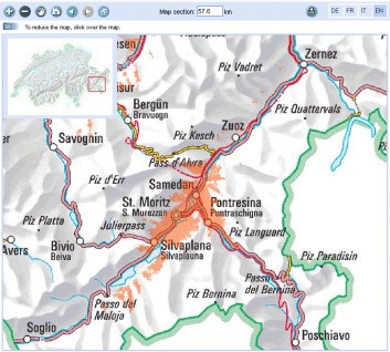
Fig. 1 Eagle eye diagram example
- REFERENCE: The start tag of the Reference Map object ~. ~Reference Map is an eagle eye map that shows the location of the map in the main window.
- LEGEND: The start tag of the Legend object. ~ It defines how the legend is generated. A corresponding legend component is automatically generated for each layer in the ~CLASS pair.
- SCALEBAR: The start tag of the Scalebar object. It defines how the map scale toolbar is generated.
Scale Bar Toolbar
Example:
# ================================================================
# Components: Reference Map, Legend, Scale Bar
# ================================================================
# ------------------------------------
# Reference Map Definition
# ------------------------------------
REFERENCE
  IMAGE images/overview_wormerl.png
  EXTENT 114052 499083 124436 505124
  STATUS ON
  COLOR -1 -1 -1
  OUTLINECOLOR 255 0 0
  SIZE 150 130
END
# ------------------------------------ # Legend Definition
# ------------------------------------
LEGEND
  STATUS embed
  POSITION ur
END
# ------------------------------------
# Scale Bar Definition
# ------------------------------------
Map definition
This section includes instructions for projection in the process of generating a map from a layer.
- LAYER: The start identifier of the LAYER object. There should be at least one layer in the MapFile file, the layer is used to generate the map. The order in which the layers are displayed on the map is reversed (first layer on bottom, last layer on top); see the LAYER section for details.
- PROJECTION: The start identifier of the PROJECTION object. You should define two types of PROJECTION objects. One is the projection of the output image (defined in the Map object) and the other is defined without the Layer. If the projections of your data are all the same, then you don't need to define any projections unless you want to do a projection transformation.
Rarely used parameters
-
CONFIG: ~ Used to configure the location of EPSG files in the ~PROJ.4 library. Using this configuration allows PROJ.4 to use the files you specify. One of the advantages is that you can avoid setting the corresponding environment variables. For example:
CONFIG PROJ_LIB /tmp/proj/. Setting other values will be passed toCPLSetConfigOption()so that you can control the behavior of the GDAL and OGR drivers. Please refer to the GDAL documentation for details. Value:[key] [value]. -
DATAPATTERN:This defines a regular expression to be applied To requests to change DATA parameters via URL requests (i.e.
map_layername _data=...)。 If a pattern doesn't exist then web users Can't monkey with support files via URLs. This allows you to isolate one Application from another if you desire, with the default operation being Very conservative. See also TEMPLATEPATTERN below. Value:\ [regular expression -
DEBUG: Enable debugging on the MAP object. The detailed information of the system operation will be output to the LOG file specified by the WEB object. See the DEBUG section for details.
-
IMAGECOLOR: Initialize the color of the map, such as the background color. When transparency is enabled (TRANSPARENT ON), the specified color is applied to transparent areas. Values:
[r] [g] [b]. -
SACLE: Computed scale of the map. Usually used in programs rather than in MapFile.
-
TEMPLATEPATTERN:This defines a regular expression to be applied to Requests to change TEMPLATE parameters via URL requests (即
map_layername_template=...)。 If a pattern doesn't exist then web users Can't monkey with support files via URLs. This allows you to isolate one Application from another if you desire, with the default operation being Very conservative. See also DATAPATTERN above. Value:[regular expression]
Output format object
Generally consider that when customizing the output format, you need to use the IMAGETYPE keyword, OUTPUTFORMAT object. Set it only if you need to change the default output format, and you should refer to it before setting it:
- The size of the image has a great influence on the performance of the image (the time required to generate the image and transmit the image). The image generated using the 256color mode is smaller than using the RGB mode.
- Depending on the data, you should consider using different color depths. For example, if you are using satellite imagery or aerial imagery, you should use RGB mode to generate images. In this case the image produced using JPEG is much smaller than the image produced using PNG24.
- When using JPEG output, you can use the QUALITY option to reduce the image size.
- Use the GD or AGG image library.
GD and AGG image library
GD is an open source library for dynamically creating images. GD can create images in PNG, JPEG, GIF and other formats. GD raw support for the generation of GIF images. However, since its acquisition by Unisys, it has informally supported "Graphics Draw".
Anti-Grain Geometry (AGG) is a high-quality 2D image rendering library developed using C++. It has anti-aliasing and sub-pixel resolution. This allows you to create high-quality images. The MapServer5.0 version and its higher versions support AGG. For the same MapFile, you can use either AGG for rendering or GD.
Fig. 2 Image processed by AGG
Output
A MapFile can define one or more OUTPUTFORMAT objects, and the supported output formats include PNG, GIF, JPEG, GeoTiff, Flash, etc.
Support for various formats depends on the libraries used when compiling the program. GeoTiff needs the support of GDAL library
Flash (swf) requires support from the MING library.
- NAME: The name of the output format used in IMAGETYPE in MapFile. Value:
[name]. - DRIVER: Generate the driver name of the output in the corresponding format. If the driver supports multiple formats, the definition of the format is fixed. For example, the driver name for GD may be
GD/Gif,GD/PNG,GD/WBMPandGD/JPEG; the driver name for Flasf is SWF. GDAL's driver name is GDAL/GTiff. PNG, JPEG, GIF can be generated using GDAL or GD (GD is more efficient). Value:[name] -
IMAGEMODE: The image mode for generating the output image. Not all non-raster images are the same as Flash. Not all supported formats have all combinations. E.g. GD/GIF only supports PC256.
- PC256: ~ Generates a false-color image using ~256 colors (MapServer's legacy mode)
- RGB: Renders the image in 24-bit Reb/Green/Blue mode. All colors are supported but transparency is not supported.
- RGBA: Renders the image in 24-bit Reb/Green/Blue/Alpha mode. All colors are supported and transparency is supported.
- INT16: Render single-band data with 16 as an Integer (integer) bit depth. Currently only valid for raster imagery and WMS layers using GDAL.
- FLOAT32: ~Renders single-band data with a Float (float) bit depth of ~32. Currently only valid for raster images and WMS layers using GDAL. Value: [PC256/RGB/RGBA/INT16/FLOAT32]
- MIMETYPE: the MIME type used by the data returned to the client through the network. Value:
[type]。
Example:
MIMETYPE "application/x-shockwave-flash"
MIMETYPE "application/x-pdf"
MIMETYPE "image/gif"
MIMETYPE "image/jpeg" MIMETYPE "image/png"
-
EXTENSION: generates suffixes for files of the corresponding file type, such as .png, .gif, etc. Value:
[type]. -
TRANSPARENT: use this parameter to indicate whether transparency is enabled for images in this format. Note: Transparency is not available when IMAGEMODE is RGB, not all formats support transparency. When using transparency, an 8-bit false color image is generated in the transparent areas, so filling other parts of the map with this color will also be transparent, so a suitable color should be used as the background color.
-
FORMATOPTION: optional parameter for driver or format. Zero or more FORMATOPTION can appear in the definition of an OUTPUTFORMAT.
-GD/JPEG: the "QUALITY=n" option can be used to set the generation quality of JPEG images. Values range from 0 to 100. -GD/PNG: "INTERLACE= [ON/OFF]", which sets whether to render the image interlaced. -GDAL/GIF: "INTERLACE= [ON/OFF]", which sets whether to render the image interlaced. -the parameters supported by GDAL/GTiff:~ are as follows ~ -TILED=YES -BLOCKXSIZE=n -BLOCKYSIZE=n -INTERLEAVE= [PIXEL/BAND] -COMPRESS= [NONE,PACKBITS,JPEG,LZS,DEFAULT]
-
GDAL: all FORMATOPTION are processed using GDAL. Refer to the GDAL documentation for details. Value:
[option]. If the defined OUTPUTFORMAT is not defined in the MapFile, the program will use it implicitly.
The following definitions:
Related to the AGG library:
OUTPUTFORMAT
  NAME 'AGG_PNG'
  DRIVER AGG/PNG
  IMAGEMODE RGB
  FORMATOPTION "QUANTIZE_FORCE=ON"
  FORMATOPTION "QUANTIZE_DITHER=OFF"
  FORMATOPTION "QUANTIZE_COLORS=256"
END

OUTPUTFORMAT
  NAME 'AGG_JPEG'
  DRIVER AGG/JPEG
  IMAGEMODE RGB
  FORMATOPTION "QUALITY=100"
END
Related to the GD Graphics library:
OUTPUTFORMAT
  NAME **gif**
  DRIVER "GD/GIF"
  MIMETYPE "image/gif"
  IMAGEMODE PC256
  EXTENSION "gif"

END

OUTPUTFORMAT
  NAME **png**
  DRIVER "GD/PNG"
  MIMETYPE "image/png"
  IMAGEMODE PC256
  EXTENSION "png"
END

OUTPUTFORMAT
  NAME **png24**
  DRIVER "GD/PNG"
  MIMETYPE "image/png"
  IMAGEMODE RGB
  EXTENSION "png"
END

OUTPUTFORMAT
  NAME **jpeg**
  DRIVER "GD/JPEG"
  MIMETYPE "image/jpeg"
  IMAGEMODE RGB
  EXTENSION "jpg"
END

OUTPUTFORMAT
  NAME **wbmp**
  DRIVER "GD/WBMP"
  MIMETYPE "image/wbmp"
  IMAGEMODE PC256
  EXTENSION "wbmp"
END

OUTPUTFORMAT
  NAME **swf**
  DRIVER "SWF"
  MIMETYPE "application/x-shockwave-flash"
  EXTENSION "swf"   IMAGEMODE PC256
  FORMATOPTION "OUTPUT\_MOVIE=SINGLE"
END

OUTPUTFORMAT
  NAME **GTiff**
  DRIVER "GDAL/GTiff"
  MIMETYPE "image/tiff"
  IMAGEMODE RGB
  EXTENSION "tif"
END
WEB Object
Defines a parameter for the WEB interface runtime. To WEB Start with END End.
- IMAGEPATH: The temporary directory where temporary images are stored. It must be available when the WEB server is running. It must start with a slash
/. Value:[path - IMAGEURL: Virtual path to access temporary images stored under IMAGEPATH. Value:
[url|virtual directory] - EMPTY: The URL to redirect to when the query fails. If no value is defined, it will redirect to the URL defined by ~ERROR. Value:
[url] - ERROR: The URL to which the error occurred. If not defined, MapServer's error message will be output. Value:
[url] - LOG: The file that stores the system log, which must be available when the WEB server is running. Value:
[filename] - MINSASLE: Minimum scaling. An image of this scale will be returned when the value requested by the user is less than this value. Value:
[double]. - MINTEMPLATE: The template used above the minimum scale, which is useful for nested applications. (Template to be used if above the minimum scale for the app, useful for nesting apps) Value:
[file|url] - MAXSCALE: The maximum zoom ratio. An image at this scale will be returned when the user requests a value greater than this value. Value:
[double]. - MAXTEMPLATE: The template used when the maximum scale is above, which is useful for nested applications. (Template to be used if above the maximum scale for the app, useful for nesting apps.) Value:
[file|url] . - TEMPLATE: The template file or URL used to represent the results in interactive mode. Value:
[file|url]. - HEADER: The template file first sent to the client. Only used in multi-result query mode. (Template to use before everything else has been sent. Multiresult query modes only). Value:
[filename] - FOOTER: The template file that is finally sent to the client. Only used in multi-result query mode. (Template to use before everything else has been sent. Multiresult query modes only). Value:
[filename] -
METADATA: Use this identifier to store arbitrary key-value pairs. Often used when configuring OGC WMS. It is also very flexible when creating templates, and any content entered here can be obtained through template transitions. example:
METADATA title “Map of China” autor “YanMing” END
Example:
WEB
    IMAGEPATH "f:/mapserver/mapimages/"
    IMAGEURL "/mapimages/"
    ERROR http://www.mapserver.ch/mapserver/ms_error.htm
    EMPTY http://www.mapserver.ch/mapserver/ms_empty.htm
    LOG f:/mapserver/logs/mapserver.log
END
QUERYMAP Object
Define how query results are rendered
- COLOR: The color of feature highlighting, the default is yellow. Value:
[r] [g] [b] - SIZE: The size of the map, in pixels. The default is the size defined in the MAP object. Value:
[x][y] - STATUS: Whether to display the map obtained from the query.
-
STYLE: Set the realistic way of querying the obtained map. Maps or map parts that are not selected are not processed.
- Normal: Render the layer in the style of the original layer.
- Hilite: Renders the selected layer using the value of COLOR.
- Selected: Show only selected layers
Value: [normal|hilite|selected]
Example:
QUERYMAP
COLOR 255 0 0
STYLE hilite
END
REFERENCE Object reference map
It is a preview showing the location of the map in the main window.
Begins with a REFERENCE and ends with an END. Three types of reference maps are supported. The most common is to show the extent of the map being interacted with in the preview. It is also possible to include a reference map as part of a query. Point query will generate an icon (an image with a marker) on the query point; face query will highlight the queried area; query given to feature will display the selected part.
- IMAGE: The name of the reference map image (including the path), which can be an absolute or relative path. Value: [path/filename.ext]
- SIZE: The pixel size of the reference map image
- EXTENT: ~The spatial extent of the image. Value: ~[minx] [miny] [maxx] [maxy]
- STATUS: ~Whether to create a ~reference map, the default is OFF. Value: [on | off]
- COLOR: The fill color of the corresponding BOX range, the default is red. A value of -1 is transparent. Value: [r] [g] [b]
- OUTLINECOLOR: ~ corresponds to the color of the border of ~BOX, the default is black, when the value is -1, there is no border. ~value: ~[r] [g] [b]
- MARKER: The mark displayed when the corresponding range becomes very small (obtained from the symbol file), the default is the cross mark. ~value: ~[integer | string]
- MARKERSIZE: ~ defines the size of the symbol that replaces ~BOX. Value: [integer]
- MINBOXSIZE: ~ When ~BOX is smaller than MINBOXSIZE, use MARKER and MARKERSIZE to display. ~value: ~[integer]
- MAXBOXSIZE: When the BOX is larger than MINBOXSIZE, nothing is rendered. Value: [integer]
Example:
# ------------------------------------
# Reference Map Definition
# ------------------------------------
REFERENCE
  IMAGE images/overview\_wormerl.png
  EXTENT 114052 499083 124436 505124
  STATUS ON
  COLOR -1 -1 -1
  OUTLINECOLOR 255 0 0
  SIZE 150 130
END
LEGEND Object In MapServer, there are three ways to create legends.
- Simple Image Legends: generate legends just like using a desktop graphics system. This approach is very simple, but it has great limitations.
- Legends using HTML templates:~ is a complex way to automatically create legends using ~ MapServer.
- Plain HTML legends:~ manually compiles the legend ~ HTML file. This method is very free, but it needs the corresponding HTML file, and it is troublesome to update it.
Simple Image Legends**
Define the mode of production of the legend file, and the CLASS object creates the corresponding legend component for each individual highlight. Start with LEGEND and end with END. The size of the legend image is not unknown before it is created, so do not use the <img> The width and height of the hard-coded image in the tag.
- IMAGECOLOR: ~ The initial color of the legend (eg background color). Value: ~[r] [g] [b].
- LABEL: The start identifier of the LABEL object.
- OUTLINECOLOR: The color of the symbol border. Value: [r] [g] [b]
- POSITION: ~ The location of the legend on the map. Defaults to ~lr. Value: [ul|uc|ur|ll|lc|lr]
- KEYSIZE: The legend box in pixels, the default is 20 X 10. Value: [x] [y]
- KEYSPACING: The space between the ~ symbols, the default is ~5 X 5. Value: [x] [y]
- POSTLABELCACHE: ~tells ~MapServer to render the legend after all labels are rendered. Useful when adding homogeneous elements. Defaults to false. Value: [true|false]
- STATUS: Whether to create this legend. Value: on|off|embed]
Example 1:
# ------------------------------------
# Legend Definition
# ------------------------------------
LEGEND
    STATUS embed
    POSITION ur
END
This legend is automatically created for all layers, the legend contains the layer name.
Example 2:
LAYER
 NAME "Restaurants"
 STATUS ON
 TYPE POINT
 DATA "restaurants.shp"
  CLASS
   NAME "Restaurants"
   COLOR 255 127 127
   SIZE 14
   SYMBOL "restaurants"
 END
END
This legend will create a legend with the "restaurants" symbol and restaurants text.
As shown below:

Legends using Templates
MapServer version 3.5 and above can use template files to generate legends. In MapFile The TEMPLATE parameter is used in the file to enable template-based legend generation. Set up TEMPLATE file, the file will replace main HTML The content referred to by the\ [legend] tag in the file. Template files must have an. Html extension.
HTML Legend template File
The HTML legend template file contains 0 or one of the following tags, and the program will use the corresponding tags
Generate the legend:
\[leg\_group\_html\] ... \[/leg\_group\_html\]
\[leg\_layer\_html <OPTIONAL PARAMS>\] ... \[/leg\_layer\_html\]
\[leg\_class\_html <OPTIONAL PARAMS>\] ... \[/leg\_class\_html\]
Anything in the legend file except the label pair above will be ignored
1) GROUP block tag: [leg_group_html]...[leg_group_html]
The HTML block that uses this tag in a group of layers is that the layers will appear in the legend. When using the [leg_group_html] tag, styles for layers that do not belong to any group (LAYER GROUP not set in the MapFile) are also not displayed in the legend. The list of groups is determined by order_metadata, which is explained later....
Tags that can appear in [leg_group_html] blocks:
[leg_group_name]Name of the group[layer_status]The state of the first layer in the group[leg\_icon width=<optional\_width> height=<optional\_height>\]The icon of the legend, [leg_icon] is the URL of the icon.metadata name=<metadata_field_to_display>]Returns the specified metadata
Example: show layer group
[leg_group_html]
<tr><td colspan=2><b>[leg_group_name]</b></td></tr>
[leg_group_html]
2) LAYER block tag: [leg_layer_html <OPTIONAL PARAMS>] ... [/leg_layer_html]When this ~ tag is not set, no ~layer header will be displayed.
The optional parameters are as follows:
l order_metadata = <field_to_order_by> You can use the value of <field_to_order_by> to control the display order and visibility of layers in the legend.
When the value of <field_to_order_by> is greater than zero, sort by this value.
If the value of <field_to_order_by> of two layers is the same, then the order of MAP LAYER is used.
<field_to_order_by> will not be displayed in the legend if the value is less than zero.
l opt_flag = <bit_mask> Controls the display process of the layer. The values are as follows:
 1. : Legend is still shown when out of Scale (default is out of Scale, no legend is shown)
 2. : The corresponding legend is still displayed when the layer status is OFF (by default, the corresponding legend is not displayed when STATUS is OFF).
 4. : The legend is still displayed when the layer type is QUERY (the default is not displayed when the TYPE is QUERY)
 8. : The legend is still displayed when the ~layer type is ~ANNOTATION (the legend is not displayed when the TYPE is ANNOTATION by default) Example: opt\_flag=12 means to display all ~layer types, including ~QUERY and ANNOTATION.(4 +8)
The tags that can appear in the [leg_layer_html] block are as follows:~
a) [leg_layer_name] returns the value of the layer name
b) [leg_icon width=<option_width> height=<option_height>] returns the URL of the legend icon
c) [metadata name=<metadata_field_to_display>] Returns the specified metadata value and WEB metadata Example: Display layer title with href link
[leg_layer_html order_metadata=WMS_ORDER visibility_flag=15]
<a href="[leg_layer_name]">[metadata name=WMS_TITLE]</a><BR> [/leg_layer_html]
3) CLASS block tag:[leg\ _ class\ _ html & lt;OPTIONAL PARAMS>] .[/ leg\ _ class\ _ html]
If not set, no style will be displayed.
CLASS whose NAME is NULL will not be displayed
Optional parameters:
l opt_flag = <bit_mask> controls the display of layers. The values are as follows:
 - 1 : Legend is still shown when out of Scale (default is out of Scale, no legend is shown)
 - 2 : The corresponding legend is still displayed when the layer status is OFF (by default, the corresponding legend is not displayed when STATUS is OFF).
 - 4 : The legend is still displayed when the layer type is QUERY (by default it is not displayed when the TYPE is QUERY)
 - 8 : The legend is still displayed when the layer type is ANNOTATION (by default, the legend is not displayed when the TYPE is ANNOTATION)
Example: opt_flag=12 means to show all layer types, including QUERY and ANNOTATION. (4x8)
Tags that can be used under [leg_class_html]:
[leg_class_name] Value of CLASS NAME
[leg_class_title] Value of CLASS TITLE
[leg_icon width=<option_width> height=<option_height>] Returns the URL of the legend icon
[metadata name=<metadata_field_to_display>] Returns the specified metadata value
and WEB metadata ~data~
Example:
\[leg\_class\_html opt\_flag=15\]
<img src=[leg_icon]> [leg_class_name]<br>
[/leg_class_html]
4) CONDITIONAL text
Label:
[if name=<field_to_check> oper=<eq|neq|isset|isnull>
value=<to_compare_with_field>]
...
[/if] The [if] tag can be inside the [leg_*_html] tag, and nesting is recommended. The value of the parameter oper can be eq (equal), neq (not equal), isset, isnull. Defaults to equal.
2.6.3 Plain HTML legends
This is another way to create a legend. Pre-processed, use HTML, PHTML, PHP, etc.
Example:
SCALEBAR Object
SCALEBAR defines the mode of production of map scales. Start with SCALEBAR and end with END. The size of the legend image is not unknown before creation, so do not hard-code the width and height of the image in the & lt;img> tag of the template file.
Note: fonts of TrueType type are currently not available.
- How many parts of the INTERVALS:~ legend bar are divided? the default is ~ 4. Value:[integer]
- UNITS: the unit of output scale bar. The default is meters. The real map can be obtained by using the map unit as its unit. Value: ~[feet | inches | kilometers | meters | miles]
- COLOR: renders the layer using the color specified by COLOR when not using the property sheet. Value:[r] [g] [b]
- IMAGECOLOR: initializes the color of the scale bar. Value:[r] [g] [b]
- BACKGROUNDCOLOR: background color. Value:[r] [g] [b]
- OUTLINECOLOR: the color of the border (border). The default value of-1 indicates an unbounded color. ~ value:[r] [g] [b]
- LABEL: note the size of the SIZE. Note: TrueType-type postures cannot be used. ~ use ~[tiny | small | medium | large | giant] to define the value of SIZE. ~ usually you should use ~ tiny or small.
- POSITION:~The position where the scale bar is placed, the default is ~lr.:[ul|uc|ur|ll|lc|lr]。
- SIZE: the size of the scale bar. Value:[tiny | small | medium | large | giant].
- STYLE: the type of scale bar. Value:[0 | 1]
- POSTLABELCACHE:~ tells ~ MapServer to render the legend after all the labels have been rendered. It is useful when adding elements of the same kind. The default is false. Value:[true | false].
- STATUS: whether to create a scale bar image and whether to embed the image. Note: you need to define a MARKERSET to embed the scale bar. In effect, the legend bar then becomes a ~custom~mark identical to the other annotations. ~Value: ~[on | off | embed].
- TRANSPARENT: whether the background of the legend bar is transparent, the default is OFF. Value:[on | off].
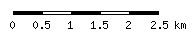
Example 1:
# ------------------------------------
# Scale Bar Definition - STYLE 0
# ------------------------------------
SCALEBAR
INTERVALS 5
UNITS kilometers
OUTLINECOLOR 0 0 0
STYLE 0
STATUS embed
  LABEL
    SIZE small
    COLOR 0 0 0
  END
END
The illustration bar is as follows:
Example 2:
# ------------------------------------
# Scale Bar Definition - STYLE 1
# ------------------------------------
SCALEBAR
INTERVALS 5
UNITS meters
STYLE 1
STATUS embed
  LABEL
    SIZE small
    COLOR 0 0 0
  END
END
The illustration bar is as follows: