Load and process S-57 ECDIS data with QGIS
The loading of ECDIS is currently limited and relies on compromised solutions from existing GIS platforms other than ECDIS engines developed by individuals or institutions alone. For example, ArcGIS S57 Viewer or use Globalmapper for viewing. According to the scheme provided by foreign netizens, use QGIS and FWTools to convert S57 data into SHP files of corresponding layers; use the QGIS plug-in Resource Sharing to get the svg symbol; then configure the style symbols for the layers through the. qgs file of QGIS to complete the loading of S57;
S57-> SHP
Just download the FWTools command line tool and convert ENC chart data in batches using the scheme provided.
FWTools is a set of open source GIS data processing toolkits developed by Frank Warmerdam, providing a convenient solution for using open source tools. It includes OpenEV, MapServer, GDAL/OGR, PROJ. 4, OGDI, Python and other subpackages. (The OGR in FWtools is used here, but not limited to FWTools. You can use the scheme containing OGR functions in any language or platform).
Usage
Open FWTools shell,
use the following command:
Ogr2ogr-skipfailures-append output-Path input-Path
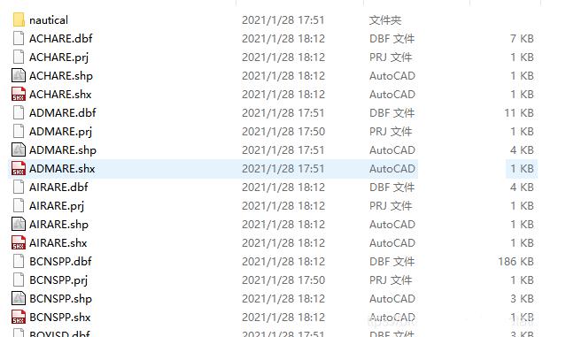
Use the ogr2ogr function to convert the input file into a shp file in the corresponding path, where the -skipfailures keyword is to skip the error, and -append is to load the shp data generated by several S57 files into the same shp file, then get the following folder:
Get symbol library
Symbols can be used using the symbol library uploaded in CSDN (https://www.kdocs.cn/view/l/sfm2DhVMnG7Y?f=131); also can use QGIS's plugin Resource Sharing;
Download the QGIS plug-in
Click Plugins-> Manage and Install Plugins...
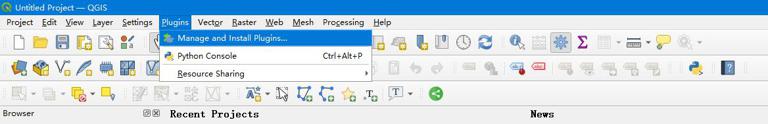
Pop-up plug-in library loading interface to find the corresponding plug-in in the search box

Click INSTALL.
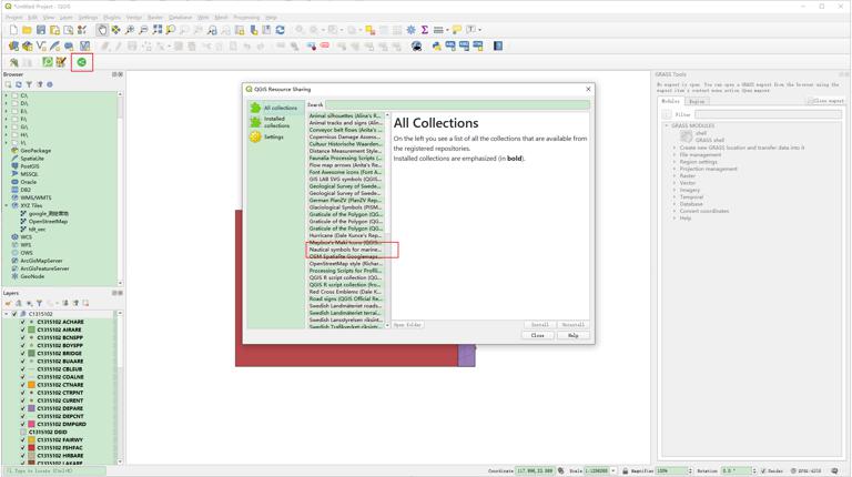
Once installed, go back to the main interface and click the resource sharing plug-in in toolbar Find the chart resource NAUTICAL Symbols for marine, just open the corresponding folder.
Load symbol library
The S57.qgs file can be found in my resources; Place the file in the shp folder mentioned above and the symbol library in the same folder (easy to find), Open the QGIS file with notepad 3 or another editor, and change the path of the symbol library index to the corresponding local symbol library file (use the editor's built-in replacement function).
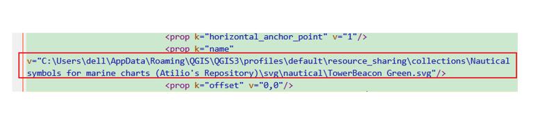
Here is the corresponding file path of the symbol library downloaded by the plug-in. After saving the file, double-click to open it.
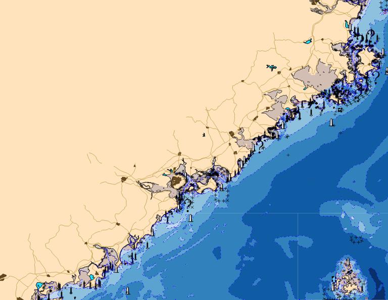
(The color of the ocean can be configured by yourself)