Analysis of the development prospects of GIS in urban planning
Because GIS has strong spatial analysis capability and modeling technology, it can help the management part of urban planning to realize dynamic and high-speed query, statistics and analysis of information, and can simulate, quantitatively analyze and predict various schemes or achievements, so that GIS can be widely used in all aspects of urban planning approval, preparation and public participation. It is conducive to the scientization of urban planning and the intelligence and efficiency of urban planning management.
1.Functional advantages of GIS
The main advantages of geographic information systems in urban planning applications can be summarized as follows: 1) being able to perform effective query and retrieval tasks; 2) Being able to quickly and widely obtain relevant information allows for the exploration of multiple solutions in a larger field; 3) It can better improve map production, make it easier to obtain maps, shorten the production cycle, and reduce storage costs; 4) Ability to enhance analytical capabilities; 5) Being able to improve service quality and shorten working hours; 6) More convenient for communication and exchange between non professionals and the public.
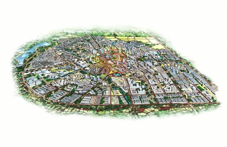
The many problems that arise in the process of urban development have also attracted our great attention. For example, in urban infrastructure construction, the laying of pipelines often leads to accidents, emergency response capabilities for urban transportation, water resources, and disasters, as well as urgent improvements and improvements. These problems seriously affect urban development and pose a great threat to people's production and life. So to solve these problems, an effective solution or method is necessary. Therefore, with the help of information technology and computer technology, geographic information systems can be constructed in the field of urban planning, such as planning assisted design, urban management planning control, auxiliary decision-making, and engineering site selection. Moreover, the use of computer technology makes storage more convenient and efficient, and sharing more timely.
2.Problems in GIS Application
1) Limitations of application. Traditional geographic information systems have a significant investment and a relatively long effective time, requiring real-time maintenance and updates, especially in database construction. Additionally, they also involve issues such as the effectiveness and accessibility of data organization. The organization and analysis of data can be said to be the basic conditions for the system in use, but in practical applications, due to the limited data, it is greatly discounted in practical applications.
2) The issue of data organization. The development information and spatial data of a city are the foundation of the design, planning, and management process. They not only include the basic terrain data of the city, but also the relevant control data of planning. At the same time, they also include the attributes of the city and the current status of urban planning. Collecting and updating these data and information is a huge task that requires a lot of material, financial, and human investment.
3) The limitations of urban planning itself. At present, in the process of urban planning in China, the construction of geographic information system software is often overlooked, and there is no unified standard for data collection, analysis, and trend prediction. The professional planning team is also not highly qualified, and the understanding of geographic information systems among general planning personnel is also limited, and the talent team is relatively lacking. These issues also pose significant challenges to the application of geographic information systems.
3.Application of GIS in Urban Planning and Management
3.1 Collection of Basic Information Data
According to survey results, the proportion of software, hardware, and data investment in the construction of geographic information systems is 2:1:7, indicating that data is the main component of the system. The data collected and stored by geographic information systems is related to urban terrain, which can provide abundant and reliable data as support for urban planning and future management. Geographic information systems integrate global positioning systems, geographic information systems, and remote sensing technologies to achieve rapid analysis, processing, and storage of the environment and urban space. Remote sensing technology mainly relies on scanning photography and processing various types of information to identify and monitor ground objects and phenomena over a relatively long distance; The global positioning system has three-dimensional positioning and navigation capabilities in all aspects such as air, land, and sea. By utilizing the powerful spatial analysis capabilities of geographic information systems, people can use the obtained images for analysis and decision-making in urban modernization planning and management, providing reliable data support and technical support for urban planning.
3.2 Approval of urban planning
At present, electronic approval is a new type of approval system that requires the responsible unit to change the drawings submitted to the approval department from the previously used paper version to electronic materials, and to change manual drawing to electronic drawing. It also requires a series of standardized technical and standardized management procedures to ensure that electronic documents can meet the requirements of standardization. By submitting the approved data in the form of CAD to the backend geographic information system database, the system achieves timely and dynamic updates, providing data support for urban approval data.
3.3 Application in Land Grading and Valuation
Land grading evaluation is to better utilize land, and it is also very important to establish a map database when conducting land grading. When establishing maps, the land situation can be reflected using topographic maps. A scale map can be used as the base map of a topographic map, and then a scanning instrument can be used to scan it. Then, image processing technology can be used to process the base map, which can obtain the data information to be used. In order to better ensure the accuracy of the topographic map, relevant coordinate values can be input into the topographic map to accurately determine the topographic map.
When establishing an attribute database for land grading, it is necessary to follow the land grading regulations implemented by the national land management. At the same time, during the grading process, it is necessary to conduct a good analysis of the natural conditions of the assessed area, which can better determine the factors affecting the location and quality of land, and also provide a good expression of the differences in land. The factors for land grading evaluation have geometric definitions and properties, which can form the spatial management objectives of point, line, and surface in geographic information systems. At the same time, there are also good regulations for the attribute indicators and attribute information data of land grading. By inputting known data and resources into geographic information systems, better land division and processing can be achieved.
3.4 Application in Land Use Dynamic Monitoring
Through the land change research system, system users can create various statistical data tables based on the known results in the process library, and use these statistical data tables to determine whether the land change data is accurate. If the land data is accurate and accurate, it can be put into the map for merging operation. In the map merging process database, by merging the already segmented land change map, a new change map can be obtained and a new land change status layer can be formed. Furthermore, we put the current land change status layer into the historical database, which can facilitate system users to query and trace these data. If there is an incorrect operation phenomenon in the current layer of land change, system users can obtain the original resources in the historical database and restore the incorrect data. The application of geographic information systems in land dynamic monitoring can provide important basis for land law enforcement and supervision. Land law enforcement supervision mainly conducts effective inspection and supervision of land management regulations and the implementation and enforcement of laws, and imposes strict sanctions on those who violate land management regulations and laws. The application of geographic information systems in land law enforcement and supervision is mainly reflected in the following two aspects: firstly, to inspect and supervise the responsibilities and law enforcement situation of regional land management departments. Secondly, strict supervision should be carried out on the land management and utilization behavior of land users and owners to prevent the occurrence of land use violations and violations.
4.Conclusion
By organically integrating geographic information systems with multimedia or the Internet, a public participation geographic information system can be established. The relevant applications of this system can upload urban planning information containing dynamic maps to the Internet, and through the popularization of the network and the basic knowledge involved in the planning plan, the public can timely grasp the approval process and the planning status of the city. When planning, it is important to make it public, which can enable the public to better participate in the evaluation and provide timely and effective feedback. Especially in the popularization and in-depth application of network information technology.