Abstract: Urban traffic is an important part of urban geography, which has been widely concerned by scholars. Urban traffic plays an impor...
Urban traffic is an important part of urban geography, which has been widely concerned by scholars. Urban traffic plays an important role in ensuring the normal operation of urban production and life and strengthening the connection between urban and rural areas. In a short time, urban traffic presents a static location relationship, while in a long time, it shows a dynamic evolution process. It is difficult to timely monitor and adjust the dynamic changes of traditional transportation planning methods. With the development of remote sensing technology, its application research in traffic planning and monitoring has become increasingly in-depth, providing a new way for urban traffic planning and monitoring research.
1.Remote sensing technology
Introduction to Remote Sensing
Remote sensing refers to a modern application technology that uses a sensor device not to contact the measured object to obtain the surface information, and studies the shape, size, location, nature and environmental correlation of ground objects through data transmission and processing. Remote sensing technology has the advantages of fast, comprehensive, dynamic, macro, multi-level and multi temporal. With the improvement of science and technology, remote sensing technology has been continuously improved and perfected. Its application field has expanded from traditional survey, mapping, etc. to urban information survey, planning, etc., and its service field has been continuously expanded. It has gained widespread attention from relevant scholars, which has important application value.
Now urban traffic is a rapidly developing open system. To implement reasonable planning, construction and management, it is necessary to timely grasp and comprehensively analyze the changes and information in its development process. Remote sensing technology can accurately and quickly obtain information about the length and width of urban traffic lines. Remote sensing technology can not only obtain the macro status and comprehensive data of urban traffic, but also obtain the micro data of urban traffic such as each line. It can provide various analysis data and basic information for urban traffic planning and development in real time and efficiently.
Characteristics of remote sensing technology
As a comprehensive technology of earth observation, remote sensing has different characteristics from other technologies, mainly summarized in three aspects:
Wide detection range and fast data acquisition
Remote sensing detection can observe a wide range of areas in a relatively short time, and obtain valuable remote sensing data. It plays an important role in mastering the current situation of ground affairs and provides valuable information.
Dynamic response to changes in things on the ground
Remote sensing monitoring can periodically and repeatedly monitor the same area, which is helpful for people to obtain data, find and dynamically track the changes of many things on the earth.
The acquired data is comprehensive
The remote sensing data acquired by remote sensing exploration is the remote sensing data of the same section covering a large range of areas. These data comprehensively show many natural and human phenomena on the earth, macroscopically reflect the shape and distribution of various things on the earth, and comprehensively reveal the relationship between geographical things.
2.Application of remote sensing technology in urban traffic planning and monitoring
Basic data survey of urban traffic
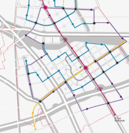
In urban traffic survey, traditional point based ground survey is not only time-consuming and laborious, but also difficult to accurately describe the basic features of urban traffic. Remote sensing data has the characteristics of wide coverage and timeliness. The overall status of urban traffic can be obtained by using remote sensing technology. According to the characteristics of urban traffic roads on remote sensing images, the basic information data of urban traffic, such as road length, road network structure, road width, size and number of parking lots, street greening, can be obtained comprehensively and accurately; Based on aerial remote sensing images, the vehicle speed, type and density on urban traffic roads can be obtained. For example, the combination of image texture features and filtering technology can highlight the linear boundary of urban traffic, and the use of edge detection and tracking processing can extract the vector map of urban traffic status.
Urban traffic planning
To fully plan the urban traffic development strategy and road network structure, it is required to have a full understanding of the urban terrain and geomorphic characteristics, traffic intersection settings, management methods, slope, length and the current situation of the road network, and to master the current situation of urban development information. Remote sensing technology can quickly and accurately obtain relevant information. According to the multi temporal remote sensing images, the direction and speed of urban expansion and the status quo of urban traffic development can be obtained, and the spatial analysis is carried out to compare the gap between urban traffic demand and urban traffic status, so as to provide a reasonable decision-making basis for the direction of urban traffic planning. At the same time, according to remote sensing images or continuous aerial photographs, the temporal and spatial distribution of urban traffic congestion can be obtained, and the full load of urban ground conventional public transport vehicles can be obtained. This can effectively grasp the actual time and space demand of urban traffic, and provide decision-making basis for urban traffic planning and adjustment.
Dynamic monitoring of urban traffic
With the rapid development of urbanization in China, cities are expanding outward, and urban space expansion has aggravated the urban traffic pressure. Many cities have many problems, such as heavy traffic flow and traffic congestion. In urban traffic planning, it is not only necessary to analyze the current situation of various elements of urban traffic, but also to monitor the changes of urban traffic. Remote sensing images can be used to obtain real-time data of urban traffic dynamic development, provide basis for urban traffic dynamic monitoring, and is an effective means of urban traffic change monitoring. The dynamic monitoring of urban traffic by remote sensing is mainly to obtain the dynamic change information of urban traffic by processing, and processing multi temporal remote sensing images. Generally, there are two kinds of monitoring methods, one is based on pixel classification, such as maximum likelihood method, support vector machine, decision tree, etc; The other is object-oriented classification, such as the nearest neighbor method, membership classification, object-oriented decision tree classification, etc.
3.Concluding remarks
In the process of urban traffic planning and monitoring, it is necessary to master a variety of basic data. Traditionally, the acquisition of these data requires field investigation, which will cost a lot of manpower and material resources, and will last for a long time. The data obtained is not comprehensive. Remote sensing technology has the characteristics of real-time, dynamic and macro. It provides a new way to investigate basic data for urban traffic planning and monitoring, and has broad application prospects, but remote sensing data also has some limitations, it can not completely replace the traditional ground survey. Therefore, urban traffic planning departments and relevant application departments should analyze the feasibility of remote sensing technology application according to specific investigation contents in the process of practical application and operation, select appropriate application schemes, so as to give full play to the value of remote sensing technology.