Abstract: In the past work of cultural relics protection, it is often encountered that due to the complex terrain environment around the cu...
In the past work of cultural relics protection, it is often encountered that due to the complex terrain environment around the cultural relics building body, people cannot see every part and detail of the cultural relics building body from a human perspective. For example, if it is necessary to map the ancient building roof or investigate the damage, it is necessary to use ladders or surrounding tall buildings. The emergence of small multi rotor UAVs provides great convenience for the work in this situation. When people's own visual angle is limited, the small multi rotor UAV can take off with a camera to provide us with detailed image data of the cultural relics and the surrounding environment.
Photogrammetry is a subject that uses the photos obtained by optical cameras to obtain the shape, size, position, characteristics and their interrelationships of the object to be photographed after processing. After obtaining the images of cultural relics, we used photogrammetric technology to analyze UAV images to provide support for the protection of cultural relics. Combined with 3D reconstruction technology, the analysis and filing of the comprehensive digitalization of cultural relics and buildings can be realized. Compared with 3D laser scanning technology, this method has the advantages of simple operation, high field operation efficiency, fast data processing in the office, better and real model effect, etc., and is suitable for promotion in the protection of cultural relics and buildings.
In recent years, there is no ingenuity and dexterous technology to develop rapidly, from one year to four, just one year, small multi-rotor without ingenuity, through four technological changes. In the past year, the rotor has integrated the wind into flight, making it all successful, realizing functions such as using water power to increase stable flight, determining point hovering, stopping and autonomous return. For forty years, it has, and so, Features of high-definition image transmission and specific positioning multi-rotor UAV. In the year of the year, with environmental perception, automatic obstacle avoidance and other functions and open, four generations of multi-rotor, unmanned movement, multi-rotation wing UAV intelligent acting for the world. With the increase of human aircraft, the relevant laws and regulations have also been continuously improved, 2 years, the middle of the month, the mass of the empty aircraft is smaller than the kilogram, and the flight is half a line, then there is nothing.
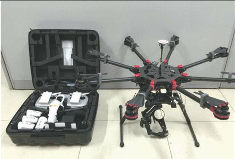
We need to choose a UAV suitable for work. Due to its slow flight speed, vertical takeoff and landing, stable hover, simple requirements for takeoff and landing sites, convenient carrying and other advantages, the electrically driven multi rotor UAV has become our choice. After selecting the UAV type, we require the working UAV to meet the following conditions. First, it has a highly safe flight performance. As the protection of cultural relics and buildings cannot be the same as the archaeological excavation site, it is impossible to completely evacuate the ground personnel from the UAV work area, or even to work in densely populated areas. This requires an integrated hardware design of the UAV. Compared with the layout of the exposed flight control and navigation system of the traditional multi rotor UAV, it has the advantages of reducing the failure rate, convenient use, and strong anti-interference ability. Many cultural relic buildings are located in mountainous areas, where the airflow is complex, so UAVs are required to have better wind resistance. Second, high-resolution images and high-definition image transmission can be obtained. Because of the preciseness of the protection of cultural relics and buildings, it is necessary to accurately control the high-definition image transmission of UAV flight. Third, in order to expand the scope of work with UAV as a platform in the future, it is necessary for UAV to have an open SDK (software development kit) to lay a foundation for the coordinated use of various auxiliary software. Based on the above requirements, we choose the DJl Inspire 1 multi rotor UAV as the working platform. The PTZ camera is 12 million pixels with a 20mm wide-angle lens.
1.UAV Image in Ancient Brick Tower Cultural Relics
Application in Building Protection
Ancient brick tower is a special category of cultural relic buildings. Due to its own shape and structure, it has always been difficult to map the building body and investigate the disease. In the past, before making the maintenance design scheme of brick tower, it was necessary to put scaffolding around the body, so that the surveying and mapping personnel could reach the tower body to survey the tower and investigate the disease. These brick towers, which have been baptized for hundreds of years, also have structural safety problems. This method not only consumes human, material and financial resources, but also threatens the safety of surveying and mapping personnel. The remote control UAV is used to collect the image of the brick tower, combined with photogrammetry and 3D reconstruction technology, and the accuracy can completely meet the requirements of surveying and mapping and disease investigation, replacing the traditional tedious on-site work.
Control point layout and UAV image acquisition
Before the remote control UAV collects images, at least 4 control points shall be arranged at the four corners of the shooting area, and the target shall be placed on the ground of the control point. The target color shall be striking to ensure that the target center can be clearly seen in the collected image. It is not recommended to use RTK and other equipment to measure the position coordinates of the target. Because the measurement range is small and the error is large, it does not meet the requirements of building surveying and mapping accuracy; The electronic total station shall be used for measurement, especially the prism free method shall be used to directly aim at the center of the control point for measurement, and the measurement accuracy can be controlled within the error of 3 to 5 mm. At the same time, it is also necessary to record the orientation and photo taking of the deployed control points to avoid entry errors in later data processing.
Before controlling the UAV to take off, it is necessary to judge the weather environment, observe whether there are interference sources, and recalibrate the geomagnetic field every time the distance between the flight sites exceeds 10km, so ensuring flight safety is the first prerequisite. The image acquisition shall be carried out in overcast days as far as possible, so as to reduce the huge contrast of exposure due to different illumination when the camera takes photos of the light and dark parts of the brick tower under direct sunlight in sunny days. Photos with large light and dark differences will increase the workload of post processing and increase the calculation difficulty of the software. Before shooting, first enter the DJl GO software to calibrate the geomagnetism. If the image is collected in sunny days, adjust the camera to the M gear, and measure the light with the camera facing the sunrise of the brick tower. With this as the standard, reduce the EV value by 2/3 gear. When the UAV takes pictures of the dark part of the brick tower, increase the exposure according to the actual situation. If the pictures taken are too dark, even if the software is used to correct them, a lot of noise will be generated in the dark part, which will affect the data processing. Before takeoff, the flight route of UAV shall be planned. Take the Wuhua Temple Pagoda in Yiyang, Henan Province as an example. The Wuhua Temple Pagoda is an ancient pagoda with blue brick structure and octagonal dense eaves. The remote control UAV flies vertically from bottom to top or from top to bottom along each corner of the Wuhua Temple Pagoda at a distance of 5 meters from the tower body. Keep the lens at an angle of 5° with the vertical direction to take a picture of the tower body and eaves on each floor of the tower. After taking one corner of the tower, continue to take another corner. When taking pictures of the tower top and the tower, the lens should be shot at an angle of 40° to the vertical. When shooting the tower base position, the lens should also have an inclination of 40° to the vertical direction, and be a little far away from the tower body, so that it is convenient to shoot the ground around the tower body and the pre arranged control point targets. After the acquisition is completed, the collected image shall be checked on the spot. If there is any part of the tower body that has not been photographed, such as the lower part of the tower eaves, the camera can be used on the ground to make up for it to ensure that there is no missed location.
Data processing and application
In the data processing stage, first adjust the brightness and contrast of the collected image to ensure that the light and dark effects of the image before processing are relatively uniform. Adjust the brightness and contrast of the image through the "color scale" and "curve" functions of Adobe Photoshop software. If necessary, you can use the "shadow/highlight" function to retrieve the details of dark or bright parts, but you should control the degree of retrieving the details according to the situation. If you set the value too high, it will cause a lot of noise and affect the quality of the 3D reconstruction model.
Agisoff PhotoScan is a software that automatically generates high-quality 3D models based on images. It does not need to set initial values and camera calibration. It uses multi view 3D reconstruction technology to process images, and can generate 3D models with real coordinates through control points. The shooting position of the photo is arbitrary, and it can be used either for aerial photos or for images taken by high-resolution digital cameras. The whole workflow is completely automatic, whether it is image orientation or 3D model reconstruction. PhotoScan can generate high-resolution orthophoto images and DEM (Digital Elevation Model) models with fine color texture. The accuracy of control points can reach the centimeter level.
Import the image into Agsoft Photoscan software, and the processing steps are divided into four steps: "Align photos", "Generate dense point clouds", "Generate meshes" and "Generate textures". First, select aligned photos, and select "High" for accuracy to generate sparse point clouds. Use the Resize Region tool to select the working area and eliminate unnecessary sparse point clouds to improve the operation speed. Select Build Dense Point Cloud to use medium or higher precision. Then, the 3D model reconstruction is completed through two steps of "grid generation" and "texture generation". The parameters of these four steps can be set according to the complexity of the cultural relics. Finally, find the pre arranged control points in the built model and input the 3D coordinates of each control point through the "Create Mark", so that each dense point cloud that constitutes the whole model has its own spatial location information.
By using the generated 3D model, we can investigate the damage of the tower body from various perspectives. Scaffolding is no longer required on site, which saves human, material and financial resources and improves work efficiency. The size of each part of the tower body can be fine mapped on the derived three-dimensional model, and the foundation settlement and tower body tilt angle can also be measured. When the UAV collects the external image of the tower body, the person carries a camera to take pictures of the interior of the tower body, carries out 3D reconstruction processing on the collected image in the same way, and then cuts the model, so that the profile of the tower body and the plan of each floor can be drawn respectively. This work method basically transferred the previous heavy field cultural relic building body mapping work to the computer in a digital form, which improved the mapping accuracy and work efficiency, and also established a complete digital archive of the cultural relic building body.
2.Application of UAV image in the protection of earthen sites
Due to the wide distribution, multiple types, complex composition and late start of protection research, the protection of earthen sites has always been a difficult problem in the field of world cultural heritage protection. Through digital photogrammetry and multi view 3D reconstruction technology, we use UAV images to conduct 3D reconstruction of the earthen ruins, quickly conduct fine mapping of the earthen ruins, provide accurate basis for the protection project, and provide reference for monitoring the preservation of the earthen ruins.
UAV route planning and image acquisition
First, four control points should be set at the four corners of the image acquisition area. Because the body of each earthen site and its surrounding environment are different, UAVs need to fly at different relative heights, so we need to prepare control point targets of different sizes. When the aircraft is flying at a relative height of 30m to 60m, it is necessary to use a target of 50cm in length and width, and when the aircraft is flying at a relative height of 60m to 100m, it is necessary to use a target of 100cm in length and width. It must be ensured that the control point target can be clearly visible in the collected image, so as to facilitate accurate marking of control point coordinates. Due to the large range of earthen sites, RTK and other equipment are required to measure the control points. At the same time, several obvious landmarks on the ground can be selected to measure their coordinate positions as standby control points.
For image acquisition of earthen ruins, UAVs are required to fly several parallel turn back airways at a certain relative height. At the same time, the two adjacent images of the acquired images have 70% - 80% of the course overlap, and the images of the two airways have 40% of the side overlap. Because each flight of the UAV has different geographical and meteorological environment background, changes in wind speed and direction will interfere with the flight of the UAV. Therefore, it is very difficult to manually control the flight of the UAV so that the UAV will not deviate from the route and collect images that meet the requirements of the overlap rate. At the same time, it is also necessary to predict and plan the working power of the UAV. Since the UAV we selected has an open SDK (software development kit), we use the third-party software Altitude to plan the route and control the autonomous flight and image acquisition of the UAV.
Data processing and application
Taking the northern city wall of Nandun Old City as an example, the image is imported into AgisoftPhotoscan software, and the model reconstruction is completed through the steps of "aligning photos", "generating dense point clouds", "generating meshes", "generating textures", and "entering the coordinates of control points". Select "Export Orthophoto", export the surface digital elevation model as a TIFF file, import the TIFF file into the Global Mapper software to generate a digital surface elevation model with contours. Since it is a digital elevation model of the surface, the plants growing on the wall surface will affect the accuracy of the contours, so try to collect images after the plants fall off in winter, the digital elevation model generated without the interference of plants is more accurate. Finally, CAD files can be exported to draw small-scale topographic maps, which can be applied to the maintenance and reinforcement design of the city wall body.
Compared with the traditional surveying and mapping methods, this method of using UAV images to map the earth site itself is not only efficient and accurate, but also avoids the secondary destruction of the earth site itself, especially for some earth wall sites with poor preservation and loose soil. Compared with the 3D laser scanning surveying and mapping method, it has the advantages of low equipment cost, small field workload and fast data processing in the office.
3.Application of UAV image in architectural heritage investigation and heritage monitoring
UAV images also play an important role in architectural heritage investigation. In recent years, the state has vigorously promoted the protection of traditional villages. In order to protect traditional villages, we must first find out the preservation status of ancient dwellings. In the past, the investigation of ancient dwellings was only to take photos of a single building body, or to draw a simple plan for the layout of a single courtyard, which could not grasp the layout of the entire traditional village and the surrounding environment. Many traditional villages are located in remote areas, lacking topographic maps. It is often encountered when sorting out research data. A detailed record of a courtyard is made, but it is unclear where the courtyard is located in a traditional village. The data collected are always fragmented, lacking records of the spatial layout of the entire traditional village.
It is low cost and fast to use UAV images to establish 3D models. It can regularly collect images of cultural relics and buildings. After a period of monitoring, the models after 3D reconstruction of images collected several times can be compared. The development of diseases and damages of cultural relics and buildings, the disappearance of traditional villages and ancient dwellings, the disease development of earthen sites and the protection effect of protection measures, and the governance of the surrounding environment of heritage can be clearly reflected, it provides a new method for heritage monitoring.
4.Conclusion
The application of UAV image in the protection of cultural relics is not only to provide more data analysis and reference, but also to change the mapping method of cultural relics. It has changed the method of only relying on tape, rangefinder and manual mapping for many years. Especially for the brick towers and brick and stone structures, the accuracy and efficiency of the whole building surveying and mapping work have made great progress. The surveying and mapping work of brick towers eliminates the previous work procedures of scaffolding, and one image acquisition completes the disease and damage investigation, building surveying and mapping and other work tasks. The mapping of the earthen site itself is more accurate and comprehensive, and the previously inaccessible places can now be clearly displayed on the three-dimensional model, which also reduces the damage of the mapping work to the earthen site.
The 3D model generated by UAV image has high accuracy and rich and realistic surface texture, providing a new way for the publicity and display of cultural relics protection units. Visitors can understand the full view of the cultural relics through a screen, and can view the cultural relics from different angles. With the VR virtual reality technology emerging in recent years, the display of immovable cultural relics has entered a new digital era.
The combination of UAV image and 3D reconstruction technology not only improves the efficiency of the protection of cultural relics, but also provides more accurate data. With the development of UAV technology and the continuous progress of related software, this method will be more widely used in the protection of cultural relics, and become an important way for the scientific and technological protection of cultural relics.