Abstract: Development achievements in recent years 1. The State Administration of Science, Technology and Industry for National Defense rel...
Development achievements in recent years
1. The State Administration of Science, Technology and Industry for National Defense released the 2017 National Report on the Application of High Resolution Satellites in China
The report reflects the latest achievements in the application of high resolution satellites, and the initial formation of the overall capacity of the corresponding country. The means to support the modernization of the national governance system and governance capacity have reached a new level. It is a programmatic report guiding the development of national remote sensing applications. The release of the report represents a substantial breakthrough in the strategic transformation of remote sensing applications from experimental applications to business services in China, and is a milestone in the field of remote sensing applications in China.
2. Integrated remote sensing survey and monitoring of soil quality in key zones of global black land
For the first time, airborne hyperspectral technology was applied to the geological and ecological survey and monitoring of the key global black soil zone (46 ° north latitude zone), and a complete technical process was established to obtain soil quality assessment from airborne hyperspectral data. The demonstration application was carried out in the black soil area of northeast China, marking that hyperspectral technology began to play an important role in the field of soil quality survey.
3. The research and development of remote sensing data service all-in-one machine creates a new mode of remote sensing data service
By forming remote sensing data service all-in-one machine products with integrated software and hardware and different levels of configuration, users can directly connect all domestic land observation satellite data, and can use the built-in "remote sensing processing factory" software platform of the all-in-one machine to conveniently and effectively complete data preprocessing, providing strong support for further application of remote sensing data to serve businesses in various industries.
4. The national receiving station network of land observation satellite data has been fully established
With the support of the National Development and Reform Commission and other ministries and commissions, after more than 10 years of efforts, a national network of land observation satellite data receiving stations has been established, which is composed of Miyun Station in Beijing, Kashi Station in Xinjiang, Sanya Station in Hainan, and Beijing Headquarters, marking the leapfrog development of China's land observation satellite ground system technology, and a major milestone in the construction of China's land observation satellite ground system.
5. The State Administration of Science, Technology and Industry for National Defense said that China is willing to share the construction achievements of the "the Belt and Road" spatial information corridor project with countries along the "the Belt and Road"
The project will make full use of China's existing and planned satellite systems and ground network systems, and is willing to share remote sensing, communication, navigation and other satellite data resources with countries along the "the Belt and Road", supplement and improve the sky information network, and jointly build a reasonably distributed and fully functional ground information service network and regional major application service system, to provide strong information support for major project construction and applications in key fields.
6. "Jilin No.1" video satellites 04, 05 and 06 were successfully launched
At 12:50 on November 21, 2017, "Jilin No.1" three optical remote sensing video satellites were successfully launched. As a result, the number of in-orbit satellites in the "Jilin No.1" constellation has been increased to 8. The revisit period of the constellation in the same area has been increased to 1 day, and the service capacity has been greatly improved. It also makes this constellation the commercial remote sensing satellite constellation with the largest number of satellites in China.
7. Hainan has initially built a remote sensing big data service platform
After years of efforts, Hainan Province has preliminarily built a Hainan remote sensing big data service platform to support Hainan Province to carry out application demonstration in four typical fields, namely coastal zone protection, ecological environment, tropical agriculture and forestry, and tourism culture, which not only greatly improves the refined management level of the government, but also provides important technical support for smart ocean construction, It has laid a solid foundation for further promoting the formation of a complete remote sensing information industry chain and the innovative development of "Internet plus" in Hainan.
8. The remote sensing satellite real-time data ensures that the Xuelong boat can successfully cross the ice area, creating a new record of successful remote sensing applications
Supported by the Xuelong Ship borne remote sensing satellite data receiving and processing system, we used the real-time received Haiyang-2 satellite data to produce sea surface wind field thematic products, and timely dispatched Gaofen 3 and other remote sensing satellites to carry out emergency observation, which played an important role in Xuelong Ship's rapid crossing of the westerly belt and ice area, and played a vital role in ensuring the smooth implementation of the 34th Antarctic scientific expedition as planned.
9. The subject of remote sensing technology of Wuhan University ranks first in the world
According to the academic ranking of world universities in 2017 released by Shanghai Soft Science Education Information Consulting Co., Ltd., the discipline of "remote sensing technology" of Wuhan University ranks first in the world, fully reflecting the rapidly growing influence and strong scientific and technological strength of Wuhan University and China in the global remote sensing academic field.
10. China has independently developed a miniature, low-power lidar system to realize business application
China's first practical miniature, low-power lidar system "AoEagle" was successfully developed in 2017. A large number of industrial applications have been carried out in an all-round way, which indicates that the micro lidar system independently developed in China is fully equipped with all terrain, multi-platform working ability, reaching the international advanced level.
Characteristics of development
After decades of development, remote sensing technology has been widely used in resources and environment, hydrology, meteorology, geological geography and other fields, it has become a practical and advanced space exploration technology. Its working principle is to use remote sensors to detect the properties of ground objects from the air, it identifies various ground objects according to the principle that different objects have different responses to the wave spectrum. The ability to perceive things remotely. That is, the use of aircraft, airships, remote sensors on satellites and other flying objects collect ground data, and get information from it, and identify the ground objects through recording, transmission, analysis and interpretation. Its characteristics are as follows: A wide range of data can be obtained. The flying altitude of the aerial photographic aircraft for remote sensing is about 10km. The satellite orbit altitude of Landsat is about 910km, so it can obtain a wide range of information in time.
The speed of obtaining information is fast and the period is short. Because the satellite revolves around the earth, thus, we can get the latest information of various natural phenomena in the area in time. In order to update the original data or carry out dynamic monitoring according to the changes of new and old data. This is incomparable with manual field measurement and aerial photogrammetry.
Access to information is subject to fewer conditions. There are many places on earth where the natural conditions are extremely bad. It is difficult for human beings to reach, such as deserts, swamps, high mountains and so on. Using remote sensing technology that is not limited by ground conditions, in particular, space remote sensing can obtain all kinds of valuable data conveniently and timely.
There are many means to obtain information and a large amount of information. According to different tasks, remote sensing technology can choose different bands and remote sensing instruments to obtain information. Making use of the different penetration of different wave bands to objects, the internal information of ground objects can also be obtained. For example, the deep layer of the ground, the lower layer of water, the water body under the ice, the characteristics of the features under the desert, etc. The microwave band can also work around the clock.
Current situation of development
The market potential of remote sensing industry is huge, the application value is extensive, and the commercial remote sensing industry is in a state of ready to start. At present, the development of remote sensing industry mainly comes from government demand, including land use, Monitoring of urbanization and desertification; monitoring and evaluation of renewable resources such as crops and forests, Disaster monitoring and environmental monitoring are playing a more and more important role in road design, urban planning, land management and engineering evaluation. It has also been applied to varying degrees in various fields such as archaeology, wildlife protection, pasture management and so on. With the continuous development of remote sensing technology, its application potential has been further tapped. Remote sensing technology will also play an important role in precision agriculture, environmental assessment, digital city and other new fields.
With the continuous increase of China's total economic output, the size of cities continues to expand. The demand for government remote sensing data extends from municipalities directly under the Central Government and provincial capitals to districts and counties. Demand for remote sensing data in planning and construction management, tourism service management, urban public safety service and traffic management in various districts and counties As a result, the characteristics of districts and counties as ordinary users of remote sensing data have become increasingly apparent. The application field and depth of government commercial remote sensing data are constantly expanding and strengthening.
At the same time, the development of the Internet and information technology It makes the earth observation data market shift from simple government orders to the common needs of the government and enterprises. China has great potential in updating maps and supporting geographic information. Internet companies such as Baidu and Tencent invest a lot of money every year in updating and purchasing remote sensing data. These enterprise needs have laid a very solid market foundation for the breakthrough development of the remote sensing industry.
Industry sales scale
At present, the sales scale of China's satellite remote sensing industry is about 7 billion yuan, it mainly includes Earth observation data and value-added service market. Satellite remote sensing data sales, satellite remote sensing data processing services. Satellite remote sensing data programming service is a traditional business in the field of satellite remote sensing, accounting for 90% of the revenue. Satellite remote sensing data sales means that users choose archived data products through websites, because users in different industries use different characteristics of satellite remote sensing data, although the demand for data products after preliminary observation is growing in quantity. However, the proportion in the whole business is decreasing year by year; The demand for satellite remote sensing applications is growing rapidly. The proportion of customized services for data products facing different needs is increasing; The satellite remote sensing data programming service is to control the satellite to obtain data in specific areas of user concern according to user needs,
On the one hand, due to the increasing number of satellites in orbit, the acquisition area and update frequency of remote sensing data have increased rapidly, archived data can meet the needs of some users. On the other hand, such services are expensive, the demand for this kind of business has not changed much since some users' demands have been suppressed.
Application field of satellite remote sensing
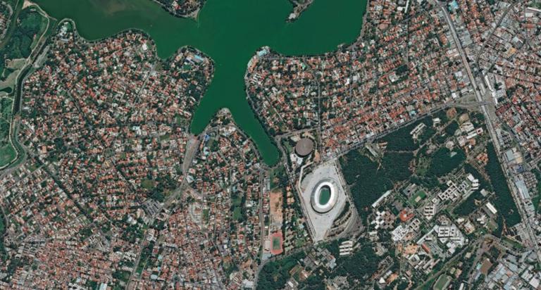
Remote sensing technology is a general term for various comprehensive technical systems for observing the Earth and celestial bodies from the ground to space. Satellite data can be obtained from the remote sensing technology platform, received, processed and analyzed by remote sensing instruments and information. In recent years, satellite maps have been gradually integrated into the network life of the public. Whether operators or ordinary people, both have a new understanding and use habits of live satellite images. Many well-known map service providers in China, such as Baidu, Tencent, Alibaba Gaode, Sogou and 360, have launched satellite maps,
Users can clearly see buildings, streets and gardens through the images on the map. With the entry of China's Tianhua, Zisan, Gaofen and other satellites, the domestic Zhongfen satellites began to lead the market, it has broken the situation that foreign satellite images dominate the domestic market, and its price has also dropped significantly. The threshold is low, so the domestic demand for high-resolution satellite data has increased significantly.
In 2013, the market scale reached 500 million to 600 million yuan, 2-3 times that of 2007, however, the use of data has more than doubled or tripled. With the application technology becoming more and more mature, satellite image applications are also more abundant, from serving the government and professional customers to mass applications. The development of the Internet has stimulated the networking of satellite data services. The principle of remote sensing fishery resources by meteorological satellite is different from that of wheat yield estimation. With meteorological satellites, the surface temperature of seawater can be measured with infrared remote sensing instruments, after drawing the contour map of seawater surface temperature distribution, then the location of the fishing ground can be determined according to the relationship between the life rules of fish and the sea water temperature, and draw a fast report chart of fishing and sea conditions. The United States and Japan already have fishing and sea status quick report systems, it includes satellite sea state map and fishery sea state map. They can be used as an important reference for fishermen in marine fishing.