Abstract: This paper introduces the spatial framing rules of Sentinel-2 remote sensing image data, and provides the download methods of .kml...
This paper introduces the spatial framing rules of Sentinel-2 remote sensing image data, and provides the download methods of .kml format files and .shp format vector files of the Military Grid Reference System (MGRS).
In the article, the Landsat series remote sensing satellite WRS strip number Path Row is introduced and the space position diagram is shown, we introduce the global image marking symbol system of Landsat series satellite - Worldwide Reference System (WRS); For Sentinel 2 remote sensing image, it has another framing rule. This article will introduce this framing rule.
First, in general, Sentinel 2 obtained an image with a width of 290 km when imaging; This width is relatively large - the Landsat 8 remote sensing image is only 185 km wide. Therefore, in order to facilitate users' access to data and prevent people from downloading too much useless data, ESA has further divided each image with a width of 290 km into smaller images with multiple scenes of 100 km * 100 km; The remote sensing image data of Sentinel 2 obtained from the official website of ESA and USGS are all small images after division.
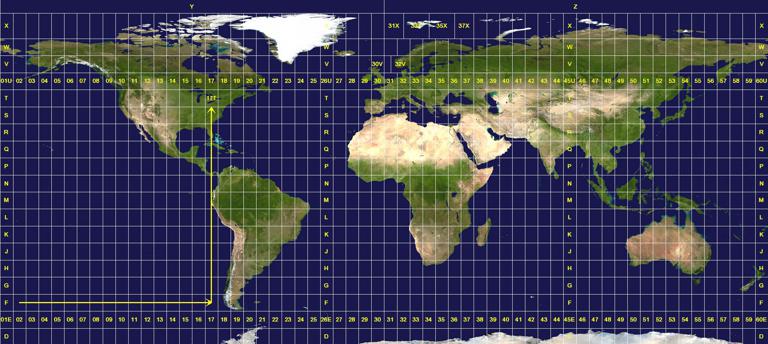
Next, let's combine the above process with geographic reference information. First of all, the 290km wide image corresponds to the Universal Transverse Mercator Grid System (UTM); This coordinate system divides the world into different grid areas based on longitude and latitude, and each area is uniquely numbered, with the first number representing the east-west position and the second number representing the north-south position. The specific division method of UTM grid is shown in the figure below.
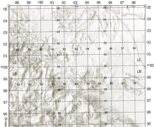
Secondly, the small image of 100 km * 100 km after segmentation by ESA corresponds to the MGRS grid. MGRS is a standard coordinate system used by NATO, which is a square grid. Based on UTM grid, it further divides each large grid of UTM into small squares of 100 km * 100 km. For these small squares, each square also has a unique code. The first letter represents the east and west positions, and the second letter represents the south and north positions. As shown in the figure below.
Therefore, it is not difficult to understand in this way - UTM divides the world into many large grids, while MGRS further divides the grids divided by UTM into many small grids; This corresponds to the original 290 km wide image of Sentinel 2 and the 100 km * 100 km small image. Therefore, we can directly use MGRS grid to represent different Sentinel 2 small images.
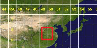
Next, we can take the strip number of Sentinel 2 remote sensing image as an example to further understand its framing and naming rules. For example, there is a remote sensing image data of Sentinel 2 located in Henan Province, and its frame number is 49SGT. The first number 49 and the second letter S are the grid number of UTM; As shown in the figure below, although the specific provincial boundaries are not marked, we can see that Henan Province (roughly the position shown in the red box) is located in the east and west stripes numbered 49 and 50, and the south and north stripes numbered R and S.
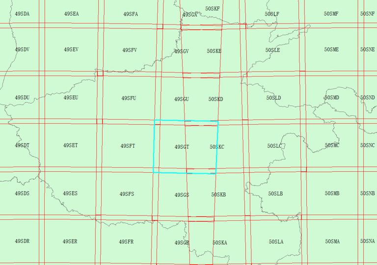
Next, the third letter G and the fourth letter T represent the specific position of the scene image in the 49S grid of UTM; As shown in the figure below, the blue area is the segmentation of the remote sensing image of 49SGT. It can be seen that the remote sensing image of this scene is at the easternmost position of the 49 belts of UTM (because another scene to the east is already the remote sensing image of the beginning of 50).
Based on the above,
we have learned the rules of the division of Sentinel 2,
and have a further understanding of the number of its different divisions.
Among them, MGRS grid .kml format files and .shp format vector files can be obtained freely in the background.
After understanding the above contents, and combining with the MGRS grid file given here, in the future practical application process, for any given research area, we can use the method mentioned in the ArcMap intersection analysis Intersect to solve the problem that the elements fall into another multi-part vector plane elements, and obtain which Sentinel 2 remote sensing image bands are covering the current research area.