11.14.1. HTML table instance 
First Name | Last Name | Points |
|---|---|---|
Jill | Smith | 50 |
Eve | Jackson | 94 |
John | Doe | 80 |
Adam | Johnson | 67 |
11.14.2. HTML form 
The form is composed of
<table>
tag to define. Each table has several rows (made up of
<tr>
tag definition), each row is divided into severalcells (by
<td>
label definition). The letter td refers to tabular data(table data), that is, the contents of data cells. Data cells can contain text, pictures, lists, paragraphs, forms, horizontal lines, tables, and so on.
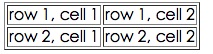
11.14.3. Table example 
Example 
<tableborder="1"><tr><td>row 1, cell 1</td><td>row 1, cell
2</td></tr><tr><td>row 2, cell 1</td><td>row 2, cell 2</td></tr></table>
It appears in the browser as follows:
11.14.4. HTML Table and Border Properties 
If you do not define border properties, the table does not display borders. Sometimes this is useful, but most of the time, we want to display the border.
Use the border properties to display a table with borders:Example 
<tableborder="1"><tr><td>Row 1, cell 1</td><td>Row 1, cell
2</td></tr></table>
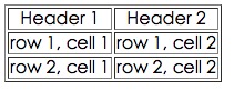
11.14.5. HTML table header 
Use of the header of the table
<th>
tag is defined.
Most browsers display the header as text centered in bold: It appears in the browser as follows:Example 
<tableborder="1"><tr><th>Header 1</th><th>Header 2</th></tr><tr><td>row
1, cell 1</td><td>row 1, cell 2</td></tr><tr><td>row 2, cell
1</td><td>row 2, cell 2</td></tr></table>
11.14.6. HTML form label 
Label | Description |
|---|---|
< table > | Define form |
< th > | Define the header of the table |
< tr > | Define the rows of the table |
< td > | Define table cells |
< caption > | Define the table title |
< colgroup > | Define the group of table columns |
< col > | Define properties for table columns |
< thead > | Define the header of the table |
< tbody > | Define the body of the table |
< tfoot > | Define the footer of the table |